Wyboston Maps
The following maps are only a selection of those held at Bedfordshire Archives. To see a larger image please click on the relevant thumbnail
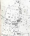
![Wyboston about 1799 [MA20]](/CommunityHistories/Wyboston/WybostonImages/Wyboston about 1799 [MA20]_150x100.jpg)
Wyboston on the Eaton Socon inclosure map of 1799 [ref: MA20]
Ordnance Survey 25 inches to the mile 2nd edition map of 1901 for the main part of the village

Ordnance Survey 25 inches to the mile 2nd edition map of 1901 for the west of the village