Northill Maps
The following maps are only a selection of those held at Bedfordshire and Luton Archives and Records Service. The image below is taken from a tracing of the Northill inclosure map of 1783 [MA2]. To see a larger version, please click on the image.
![Northill in 1783 [MA2]](/CommunityHistories/Northill/NorthillImages/Northill in 1783 [MA2]_350x301.JPG)
Northill in 1783 [MA2]
The two images below are taken from the Ordnance Survey 25 inches to the mile series maps for the area showing Northill itself - the 1st edition of 1884 and the second edition of 1901. Again, to see a larger version, please click on the relevant image.
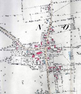
The village in 1884
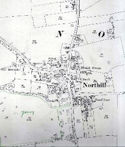
The village in 1901