The Parish of Colmworth in General
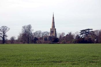
Colmworth church in the landscape March 2007
Landscape
The parish is in a rough crescent shape. Volume III of The Victoria County History for Bedfordshire was published in 1912. At that date the parish comprised 2,147 acres. 1,004.75 of these were used for arable farming, 823.75 acres were permanent grass and 32.5 acres were woodland. The chief crops were wheat, barley, oats and beans.
The parish lies on a plateau, the solid geology of which is Oxford Clay, a mudstone formed between 154 and 164 million years ago in the warm, shallow seas of the Jurassic Period. The superficial geology is mostly a type of diamicton known as Oadby Member.
The highest point is just 250 feet above sea level, near Cherry Orchard. Colmworth is cut by a number of small valleys cut by streams and the lowest part of the parish, at 125 feet above sea level is in one of these valleys just south of Dean Farm. The church stands at 220 feet above sea level and Cornfields Hotel at 230 feet. The former windmill stands at 190 feet and The City about 220 feet.
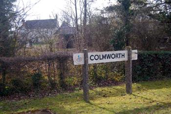
Colmworth name board in March 2007
Name
Two explanations for the name have been made. In The Place Names of Bedfordshire and Huntingdonshire by A. Mawer and F. Stenton, of 1926, the name is stated to mean "Culma's Enclosure", Culma being an Anglo-Saxon personal name. The Oxford Dictionary of English Place Names suggests a rather more convoluted explanation which depends on there having been a nearby settlement (now lost) called Culham, the name would then have meant "The Enclosure of the Culham People". There was a lost settlement nearby but that was called Langnoe, meaning "Long Hill".
Colmworth was had a wide variety of different spellings in the last thousand years, as witness the following:
- Colmeworde: 1086;
- Culmeworde: 1086;
- Colmeborde: 1086;
- Colmwurda: 1167;
- Colneworth: 1202;
- Culmwrthe: 1202-1240;
- Culmwurthe: 1202-1240;
- Colmewrthe: 1203-1276;
- Colmewurthe: 1203-1276;
- Comwrth: 1219;
- Comord: 1219;
- Colmewrdh: 1220;
- Cumewrth: 1227;
- Colmorth: 1227-1549;
- Columwrth: 1227;
- Culmwrth: 1240;
- Colewurth: 1240;
- Colmeswurth: 1247;
- Colmworth: 1247-1373;
- Colmurthe: c.1272;
- Colmsworth: 1276;
- Colmeworth: 1276-1373;
- Colmorde: 1284-1387;
- Colmoord: 1427;
- Colmorth alias Colmord: 16th century;
- Coulemorth: c.1600
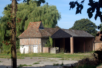
Manor Farm barns August 2009
Administrative History
Colmworth is an ancient parish in the Barford Hundred. It underwent boundary changes in 1948, when a small portion was transferred to Bolnhurst and Keysoe [CDP58] and 1956, on the latter occasion due to changes in watercourses [CDP65]. Colmworth is bordered to the north by Little Staughton, to the north-east by Staploe (by Eaton Socon until the that parish was divided and Eaton Socon itself transferred to Huntingdonshire in 1965), to the south-east by Colesden (formerly part of Roxton but now by the civil parish of Wyboston, Chawston and Colesden), to the south-west by Wilden and to the west by Bolnhurst (now part of the civil parish of Bolnhurst and Keysoe).

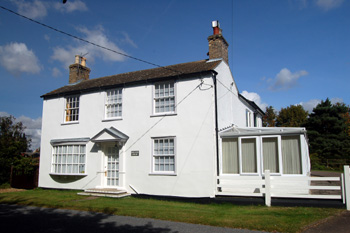
Channels End Farmhouse September 2009
Ends
Colmworth's ends begin to be mentioned in the 13th century. In the Coroner's Rolls for 1268 [Bedfordshire Historical Records Society volume 41] Sutende [South End] is named and in the Bushmead cartulary [BHRS volume] Penyshende [Pennys End] and Mylle Ende [Mill End] are named. The parish had a hamlet called Langnoe in the Middle Ages which has since been lost. Over End was first recorded in 1588, later becoming known as Chapel End. Brook Lanes End was first mentioned in 1602, Channels End in 1614 and Church End in 1668 with a Mile [Mill?] or Godfreys End noted in 1820 [WG2101]. Local legend states that The City was named by immigrants from the French city of Strasbourg in the 16th century.
Holland House September 2009
Population
The population of Colmworth today is little different to that two hundred years ago. This figure has not been constant, however. As is commonly seen in Bedfordshire rural parishes population figures peaked in the middle of the nineteenth century, only to fall away as jobs on the land decreased with the advent of mechanisation and people moved to towns. The lowest point was in 1921 from which the parish has steadily grown again, particularly since World War Two:
- 1801: 347;
- 1811: 321;
- 1821: 450;
- 1831: 468;
- 1841: 575;
- 1851: 543;
- 1861: 527;
- 1871: 508;
- 1881: 385;
- 1891: 365;
- 1901: 297;
- 1911: 276;
- 1921: 250;
- 1931: 265;
- 1951: 271;
- 1961: 309;
- 1971: 386;
- 1981: 385;
- 1991: 375;
- 2001: 369;
- 2011: 393.