Colmworth Maps
The following maps are only a selection of those held at Bedfordshire Archives. To see a larger version of each map, please click on the relevant thumbnail.
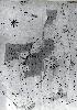
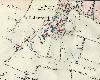
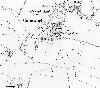
Colmworth in 1765
![Lordship farm survey of 1765 [MDBC504]](/CommunityHistories/Colmworth/ColmworthImages/Lordship farm survey of 1765 [MDBC504]_100x56.jpg)
Lordship farm survey of 1765 [ref: BC504]
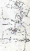
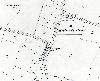
Inclosure Map of 1838
Colmworth on the inclosure map of 1838 [ref: MA64]
First Edition Ordnance Survey 25 Inches to the Mile Maps of 1884
Channels End in 1884

Chapel End in 1884
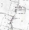
Roothams Green in 1884
The City and the northern part of Church End in 1884
The southern part of Church End in 1884
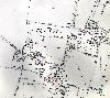
Second Edition Ordnance Survey 25 Inches to the Mile Maps of 1901
Channels End in 1901

Chapel End in 1901
Roothams Green in 1901
The City and the northern part of Church End in 1901
The southern part of Church End in 1901