Sheep Lane Maps
The map below is the Sheep Lane section of the Potsgrove tithe apportionment map of 1845 [ref: MAT36]. To see a bigger version please click on the image
![Sheep Lane in 1845 [MAT36]](/CommunityHistories/SheepLane/SheepLaneImages/Sheep Lane in 1845 [MAT36]_186x300.JPG)
Sheep Lane in 1845 [ref: MAT36]
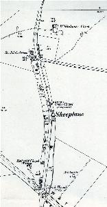
The map below is the second edition Ordnance Survey 25 inches to the mile map of 1901. To see a larger version please click on the image.

Sheep Lane in 1901
Both these maps show how much larger Sheep Lane was in the past. There had already been shrinkage between 1845 and 1901 due to the Great Agricultural Depression of 1873 to 1896.