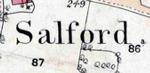
The Community of Salford in General
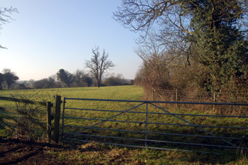
Looking from Brittens Lane towards the mill January 2011
Landscape
Volume III of The Victoria County History was published in 1912. It noted that the parish then contained 975 acres, evenly divided between arable and grazing. The principal crops were wheat, oats, barley, peas and beans.
The village lies in the south-east part of the parish, which slopes a little west to east. The parish is drained by a stream, a tributary of the River Ouzel, running west in the south of the parish. The church stands at 255 feet above sea-level and the mill about thirty feet lower than this.
The solid, or underlying, geology is a mudstone known as Oxford Clay Formation. It was laid down between 154 and 164 million years ago in the warm, shallow seas of the Jurassic Period. Along the brook is an alluvium of clay, silt, sand and gravel. The superficial geology north of the village and along Wavendon Road is a glacial till, a diamicton laid down in the Ice Ages of the mid-Pleistocene Epoch. A sand and gravel pit west of the village attests to river terrace deposits.
Name
The parish is not pronounced like the conurbation in Lancashire but as "Safford". The name Salford comes from the Old English word "Sealh" meaning willows, hence the name means willow ford. The name has appeared in the following forms over the years, the modern form first being found in 1247:
- Saleford: 1086-1302;
- Seleford: 1198;
- Salleford: 1220;
- Shalford: 1276;
- Sawford: 1610;
- Salford alias Sawford: c. 1650;
- Sarford: c. 1750.
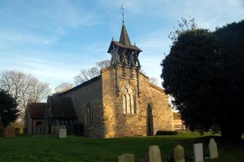
Salford church February 2007
Administrative History
Salford was an ancient parish. It was united with Hulcote for ecclesiastical purposes in 1750. The two civil parishes being joined in 1933 as Hulcote and Salford. The boundary line between Hulcote and Salford to the north and Aspley Guise to the south used to follow the line of the stream on which Hulcote Mill stood. In 1984 the boundary was changed to be the middle of the M1 thus giving Hulcote and Salford a good deal of additional land, including the area known as Salford Ford in the vicinity of the Red Lion [CDP82].
Salford is bordered by Hulcote to the east, Cranfield to the north and Aspley Guise to the south with the Buckinghamshire parish of Wavendon and the Buckinghamshire parish of Broughton, now part of Milton Keynes, to the west.
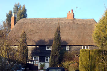
College Cottages January 2008
Parish and Population
The Domesday Book of 1086 lists seventeen men in Salford. This figure needs to be multiplied by a factor of at least four to account for their dependents, giving an estimated population of around 70. This compares quite well with the following figures taken from censuses, suggesting that Salford had a proportionately greater population in 1086 than in the 19th, 20th or 21st centuries given the much greater size of the country in more recent times (between 1,500,000 and 2,500,000 in 1086, 8,308,000 in 1801, 30,515,000 in 1901 and 49,138831 in 2001). The population fell dramatically between 1871 and 1911 as families got smaller and people left the countryside for the towns.
- 1801: 210;
- 1811: 235;
- 1821: 312;
- 1831: 340;
- 1841: 325;
- 1851: 309;
- 1861: 264;
- 1871: 256;
- 1881: 221;
- 1891: 178;
- 1901: 147;
- 1911: 136;
- 1921: 125;
- 1931: 133.
For Hulcote and Salford combined:
- 1951: 233;
- 1961: 207;
- 1971: 179;
- 1981: 207;
- 1991: 182;
- 2001: 182;
- 2011: 209.