The Parish of Chalgrave in General

Chalgrave November 2014
Landscape
Chalgrave is a composite parish largely formed by two hamlets - Tebworth and Wingfield plus an area round the church, including Manor Farm and Church Cottages, which is all that remains of the medieval village of Chalgrave. A description of the landscape for Tebworth and Wingfield will be found under those respective hamlets. The parish stands at some elevation.
Around the church the solid, or underlying geology, is known as gault formation, a sedimentary rock formed approximately 99 to 112 million years ago in the warm, shallow seas of the Cretaceous Period though, as noted below, here are pockets of chalk too. The superficial geology is till - a diamicton formed up to 2 million years ago in the ice age conditions of the Quarternary Period.
Around the church the height above sea-level is 465 feet. The club house of the golf course nearby stands at 400 feet.

Name
Chalgrave probably means "chalk pits". A. Mawer and F. M. Stenton in their 1926 publication The Place-Names of Bedfordshire and Huntingdonshire note picturesquely that antiquarian Fred Gurney of Claridges, Eggington, noted: "somewhat unexpectedly, chalk is found here and that the shepherds in driving their stakes frequently strike hard chalk".
The name has had the following variations over the years:
- Cealhgræfan: 926;
- Chelegrave: 926;
- Celgraue: 1086;
- Chealgraue: 1163-1187;
- Chalgraue: 1173-1366;
- Calgrava: 1177;
- Chalkgrave: 1220-1308;
- Chaugrave: 1220-1286;
- Chagrave: 1286;
- Chalfgrave: 1346.

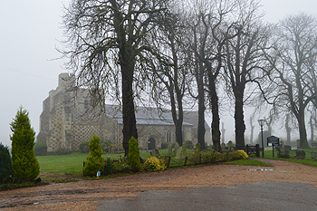
Chalgrave church on a misty morning November 2014
Administrative History
Chalgrave is an ancient parish forming part of Manshead Hundred. As noted above it is principally composed of two hamlets, Tebworth and Wingfield and, though the name applies to the whole parish it is only the area round the church which tends today to be known as Chalgrave. The parish had two manors recorded by the Domesday Book of 1086.
The parish is surrounded by Toddington to the north and east, Houghton Regis to the south-east, Tilsworth to the south-west, Hockliffe to the west and Battlesden to the north-west.
Until 1929 Chalgrave extended well into what is today the parish of Hockliffe. This boundary had been in place since at least 926. Everything east of Watling Street from just north of the school, at Clipstone Brook down as far as the road to Tebworth was then part of Chalgrave but was, sensibly, transferred to Hockliffe in that year [MCDP34]. In 1985 more of this land was transferred from Chalgrave to Hockliffe, all of this was agricultural land apart from the houses at Nineland [MCDP87/2]. A small, uninhabited area south of Warmark Farm in Toddington was also cleaned up with an exchange of a few acres of land between the two parishes to create a straighter boundary [MCDP87/2], with a similar exchange of land just west of the Chalton sewage treatment works [MCDP87/3].

The former Shoulder of Mutton at Tebworth, February 2013
Population
The Domesday Book of 1086 records two holdings in Chalgrave. The major one contained thirteen villagers, four smallholders and six slaves. This total of twenty three are the heads of households, so to arrive at a rough estimate of the total population one needs to multiply this by a factor of at least four suggesting a population between ninety and one hundred.
Censuses between 1801 and 2011 record the following population figures for the parish of Chalgrave:
- 1801: 534;
- 1811: 633;
- 1821: 710;
- 1831: 746;
- 1841: 818;
- 1851: 952;
- 1861: 961;
- 1871: 993;
- 1881: 873;
- 1891: 730;
- 1901: 593;
- 1911: 573;
- 1921: 541;
- 1931: 377;
- 1951: 364;
- 1961: 319;
- 1971: 358;
- 1981: 387;
- 1991: 447;
- 2001: 477;
- 2011: 475.
The decline in population after 1871 is accounted for by the great agricultural depression from about 1873 to about 1896 when people were forced off the land and into nearby towns in order to find work. The great drop in population between 1921 and 1931 was due to the loss of a large number of houses along the east side of Watling Street to Hockliffe.