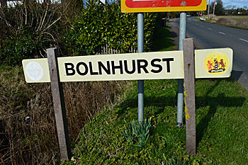
The Community of Bolnhurst in General
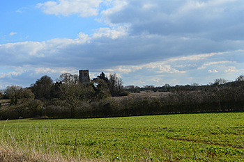
Bolnhurst church in the landscape February 2016
Landscape
Bolnhurst lies on a bedrock geology of Oxford Clay, a mudstone laid down between 154 and 164 million years ago in the warm, shallow seas of the Jurassic Period. The soil is dominated by Oadby Member, a diamicton formed up to two million years ago in Ice Age conditions. The land around the church is 260 feet above sea-level.
Volume III of The Victoria County History for Bedfordshire was published in 1912. It quotes the agriculturalist Arthur Young (1741-1820) who had an opinion of “a practical and enlightened farmer” of the neighbourhood of: “a wet, heavy, bad country very disadvantageously circumstanced respecting roads, for every way around they are almost impassable … after inclosing [1778] fell into bad hands, they laid much of it down to grass in as bad order as possible, and it has continued so ever since in as rough and ill-conditioned and unprofitable a state as can be conceived … It should seem that corn has there been lessened without making amends for the loss by ample products of new grass”. The Victoria County History noted the chief crops in 1912 being wheat, barley and oats.
Name
The Place Names of Bedfordshire and Huntingdonshire by A Mawer and F M Stenton was published in 1926. The authors identify the name as meaning Bol(l)a’s wood , the first element being a personal name. The name has had the following variations over time:
- Bolehestre: 1086;
- Bulehestre: 1086;
- Bollenhirst: c. 1150;
- Boleherst: 1179-1262;
- Bolehurst: 1179-1262;
- Balnherst: 1202-1428;
- Balnhurst: 1202-1428;
- Bolhurst: 1220-1276;
- Bolherst: 1220-1276;
- Bonehurst: 1227;
- Bolneherst: 1240-1399;
- Bolnherst: 1240-1390;
- Bolnhirst: 1240-1390;
- Bolnhurst: 1240 to date
- Bolesherst: 1240;
- Bollehurst: 1242-1253;
- Bolehirst: 1247-1302;
- Bolehurst: 1247-1302;
- Bolenhurst: 1247[1283;
- Bolenherst: 1247-1283;
- Bollenhurst: 1287-1358;
- Bolnehurst alias Bownest: c. 1550;
- Bolnest: 1493;
- Bonehurste alias Bolenhurste: 1596.
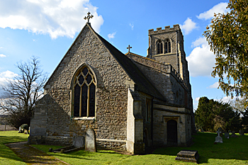
The church from the north-east February 2016
Administrative History
Bolnhurst is an ancient parish in the Stodden Hundred. It is surrounded by Keysoe to the north, Little Staughton to the north-east, Colmworth to the east, Wilden to the south-east, Ravensden to the south, and Thurleigh to the west. In 1934 the civil parish was merged with that of Keysoe to form the civil parish of Bolnhurst and Keysoe. The eccelsiastical parish was united those of with Keysoe and Little Staughton in 1957.
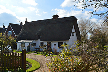 Rose Cottage February 2016
Population
The Domesday Book of 1086 gives a total population of 11 villagers and 14 smallholders for a total of 25 in Bolnhurst. As this number represents the heads of household, to get an idea of the total population it is probably necessary to multiply this figure by a factor of at least four suggesting a total population to somewhere around 100. This makes it a substantial settlement for the place and time, Ampthill, for example had about 36 people and Woburn 68.
Censuses from 1801 give the following population figures. Those since 1951 are for the new civil parish of Bolnhurst and Keysoe:
- 1801: 225;
- 1811: 230;
- 1821: 264;
- 1831: 300;
- 1841: 344;
- 1851: 378;
- 1861: 348;
- 1871: 317;
- 1881: 268;
- 1891: 223;
- 1901: 188;
- 1911: 184;
- 1921: 182;
- 1931: 162;
- 1951: 588;
- 1961: 583;
- 1971: 588;
- 1981: 639;
- 1991: 667;
- 1901: 732;
- 1911: 719.