The Community of Chawston in General

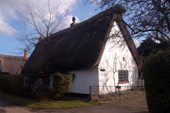
Little Thatch March 2010
Landscape
Chawston is a small hamlet lying due north of the village of Roxton and in the early twenty first century contains a number of nurseries utilising the rich, almost fenland soil. The solid, or underlying, geology is Oxford Clay, a mudstone laid down between 154 and 164 million years ago in the warm, shallow seas of the Jurassic Period. Along the South Brook the top soil is alluvium - a mixture of clay, silt, sand and gravel. Otherwise the superficial geology is a river terrace deposit of sand and gravel.
South Brook runs between Chawston and Roxton. The highest point lies at 273 feet above sea level and the lowest, on the A1, just 60 feet; the settled area averages between 65 and 85 feet.

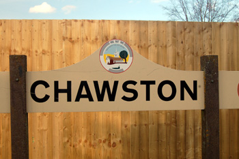
Chawston sign March 2010
Name
Chawston is first recorded in the Domesday Book of 1086. The name may mean “Cealf’s thornbush”, less likely is that it means calf's thornbush. The name has undergone a number of variations over time:
- Chauelestorne: 1086;
- Calnestorne: 1086;
- Caluesterne: 1167-1203;
- Chaluesthorn: 1180;
- Chauesterne: 1202;
- Chauuesterne: 1202;
- Calsterne: 1220;
- Chaluesterne: 1227-1400;
- Chalueston: 1227-1302;
- Chalston: 1418-1478;
- Chalsterne: 1428-1441;
- Chauston: 1535;
- Chawson: 1826.
Chawston Manor in 1961 [Z53/97/7]
Administrative History
Chawston was originally part of the ancient parish of Roxton but on 1st April 2007 it became part of a newly formed civil parish made up from Roxton's three hamlets and called Wyboston, Chawston and Colesden. It is interesting to note that Chawston and Colesden are described as a single township in 13th century coroners' rolls.