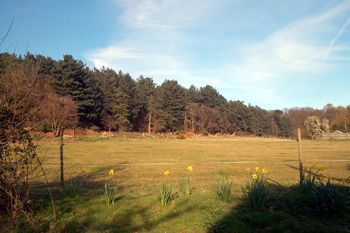
Redstone Hill April 2010
Stratford has a rich variety of sites and find spots pre-dating the Norman Conquest. The northern part of the settlement was hitherto called Chesterfield and is so marked on maps. Chester is an Anglicization of the Latin word "castra" meaning a military camp. The Bedfordshire Historic Environment Record [HER] lists all prehistoric, Roman and Anglo-Saxon sites known in the county and is now on-line as part of the Heritage Gateway website.
The earliest evidence of human activity in Stratford dates to the Mesolithic. Implements have been found in the centre of the Sandy Lodge hillfort, itself of Iron Age date (see below) [HER 11614]. Further Mesolithic activity is indicated by the quantity of flints found in the area of the Sandy hillforts including Galley Hill (see below) [HER 1165].
A local tradition is recorded that Stone Axe Farm (previously the Stone Axe Public House) gets its name from a find of stone axes at an unspecified date [HER 1165]. These, if they existed, may have dated to Palaeolithic, Mesolithic, Neolithic or even Bronze Age [HER 2434].
The Historic Environment Record details three sites in Stratford which can only tentatively be identified as prehistoric. More accurate dating cannot be given unless artefacts can be found in situ:
- HER 13712: a cropmark west of Galley Hill shows a single three-sided rectangular feature which appears to be open on the south side.
- HER 13714: a cropmark at Chesterfield contains a square feature with an attached circular feature and a semi-circular feature adjoining the square on its north-east side. This probably indicates a building or small enclosure, the associated semi-circular features may indicate another complex of features.
- HER 13715: another cropmark at Chesterfield has a number of rectilinear and square features on a north-east orientation. The features are all close to each other and suggest that they maybe a building complex.
Stratford is, however, dominated by two Iron Age hillforts and by later Roman occupation.
The Historic Environment Record details a hillfort near Sandy Lodge [HER 11614] thus: "Iron Age promontory fort, located on the edge of the Greensand ridge above Sandy. It occupies the tip of a narrow spur which extends southwards from the ridge and commands wide views across the valley of the River Ivel to the west and Biggleswade Common to the south. The promontory fort was originally roughly oval in plan, although part of the north western side was destroyed by a sand quarry in the 19th century. Otherwise the fort is largely defined by the topography of the spur. The relatively level area of the interior measures approximately 75 metres east to west and 150 metres north to south, surrounded by steep natural scarps on all but the northern side. There is no evidence for a bank around the rim of the plateau, although a timber palisade would have provided sufficient defence in addition to the gradients. The southern end is marked by a steep slope which descends approx 25 metres to the foot of the spur, while to the east and west equally severe slopes lead into dry valleys which divide further spurs along the edge of the Greensand ridge".
"The fort is separated from the high ground to the north by a broad ditch, around 10 metres wide and 3 metres deep, which is cut across the neck of the spur and linked to the head of the dry valley to the east. Small scale excavations in 1969 demonstrated that the terminal of this valley had been artificially enlarged during the construction of the ditch, and that material from the ditch itself was used to form the bank which flanks its southern edge. The bank measures approximately 2 metres in height and 10 metres in width. A trial trench placed across the western end in 1969 showed that it was composed almost entirely of sand, stabilised during construction with branches or wattle, and held in place by a small stack of turves along the inner side and a low wall of sandstone blocks along the outer edge. The ditch terminates in a rounded end 20 metres from the eastern side of the spur, to the west of which lay the original entrance to the monument. Trial excavation here revealed a causeway of sandstone bedrock and a single post hole which may have supported part of a gateway."
"The old sand quarry to the west has reduced the width of the causeway to about 10 metres and removed all evidence for the probable continuation of the bank and ditch. A small excavation in the centre of the fort in 1968 demonstrated the preservation, 0.45 metres below the present surface, of a layer of dark brown sand containing fragments of early Iron Age pottery and numerous flint blades and flakes largely dating from the Mesolithic period. The excavated sections of the ditch, bank and entrance causeway were devoid of pottery but contained further flint artefacts doubtless disturbed from earlier contexts during the construction process. The date range of the pottery, combined with the simplicity of the fort's construction, is thought to indicate that the fort was established very early in the Iron Age. Furthermore, evidence for rapid silting up in the ditch and a lack of significant erosion over the causeway is taken to suggest that the fort either remained in use for only a short period, or was never completed".
"The dry valley to the west of the promontory fort separates the monument from a broadly parallel spur, the southern tip of which is occupied by a second Iron Age hillfort (Galley Hill, the subject of a separate scheduling) [see below], believed to be later in date. These two are approx 150 metres apart. A third hillfort, Caesar's Camp, lies approximately 1.5kilometres to the north-west.
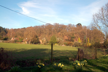
Looking towards Galley Hill April 2010
The Historic Environment Record entry for Galley Hill [HER 445] reads as follows: "a sub-rectangular hillfort occupying a prominent position on the tip of Galley Hill, a narrow spur extending southwards from the Greensand ridge and overlooking the Ivel valley. The hillfort is surrounded on all but the north side by steep slopes and its shape is dictated by the topography. It is rectangular with rounded corners, with a level interior measuring approx 110 metres east to west by 60 metres north to south. Ramparts survive on all but the eastern side. The northern section of the ramparts includes a single inner bank, 1.5 metres high and 6 metres wide, flanked by a ditch of similar width, the ditch is largely silted up and is now approx 0.8 metres deep. Around the western and southern sides there are also traces of an outer, counterscarp bank enhancing the slope of the hill. The eastern side may have relied on the natural slope, perhaps with a timber palisade. There are three narrow causeways across the northern arm of the defences, two of which relate to modern trackways. The third, located approx 30 metres from the eastern end of the north side, was probably the original entrance. Iron Age pottery has been found in the enclosed area; reports of Roman coins found here refer in fact to the Roman settlement in the valley. The site relates to HER 442 (Caesar's Camp) and HER 1164 (Sandy Lodge) [see above]. It is a Scheduled Monument (Number 27164)".
Two sites in Stratford show occupation in the Iron Age and the Romano-British period. In 1954 D.E Johnston conducted some small excavations near "The Bungalow" in Stratford Road. A ditch associated with Belgic [Iron Age] occupation had been back-filled in early Roman times, and the top consolidated with a layer of rammed gravel, which was interpreted as being the main Baldock-Sandy Roman road. Roman pottery nearby showed that occupation continued in the area [HER 11311]. Construction of a house extension at 5 Stratford Road in 1979 revealed a pit containing Belgic [Iron Age] pottery, while unstratified sherds and a bronze pin demonstrated occupation in the Roman period [HER 11323].
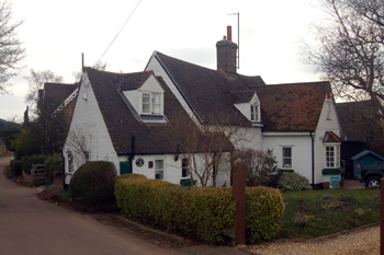
2 Stratford Road March 2010 - in that part of the hamlet known as Chesterfield
The Historic Environment Record has a general entry [HER 444] for the small Roman town at Chesterfield which reads as follows: "The area known as Chesterfield was the first area of Sandy to produce substantial evidence of Roman occupation. From the 17th century onwards finds of coins at other times were made, a circumstance attributed to the fact that the area was a market garden and under close cultivation. During the 18th century a large number of glass and pottery vessels were dug up, often containing cremated bone, and with them items such as toilet implements, brooches and a fragment of a mirror. A sword was also said to have been found. Many of these items are now lost. Fieldwalking in the 1970s at Chesterfield area produced a large quantity of pottery sherds. The cremations have been interpreted as roadside burials south of the main settlement, part of which was excavated on the site of the modern cemetery (HER11313) [see below].The approximate line of the Roman road from Baldock to Godmanchester [HER 505 see below] runs through the Chesterfield site, and there were reports of the metalling being dug out in the 20th century".
The Viatores, a group dedicated to finding Roman roads in the modern landscape, has identified a road running from Sandy, through Stratford, to Godmanchester [Cambridgeshire] [HER 505]. The road ran through Little Barford, Tempsford, Everton, Sandy, Biggleswade and Stotfold. The southern part of this running through Stratford, Biggleswade and Stotfold was an extension running on to Baldock [Hertfordshire]. The Baldock road enters Bedfordshire at Radwell and is marked by modern roads as far as Biggleswade. North of Biggleswade the line is more conjectural. At Sandy the line of the road is traced as a series of hedgelines, partly on aggers [Roman roads with ditches at either side]. A Roman ford [HER 3321] has been tentatively identified in Stratford but the stream was diverted when the railway was built in the mid 19th century.
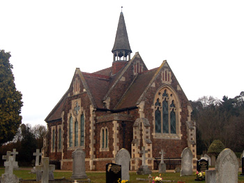
The chapel in Sandy Cemetery March 2010 - also in Chesterfield
The Historic Environment Record [HER 11313] notes that many Roman finds have been made at Sandy cemetery, situated in the north corner of Chesterfield. There is some evidence of building remains, in layers of "crumbled brick" and a surface of flat sandstone. Refuse pits produced large quantities of broken pottery, a fragment of glass vessel, a pewter dish and bronze ornaments. One pit contained three skeletons, buried head first. A hard metalled surface running east-north-east/west-south-west may have been one of the main streets of the settlement. Many of the finds and pottery from the cemetery date from the 1st and 2nd centuries.
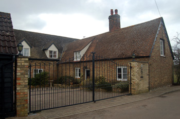
6 Stratford Road March 2010
Archaeological investigations have shown evidence for a small settlement and a cemetery of a 4th century date to the north-west of 6 Stratford Road [HER 11309 and 13407]. The site is divided into two zones, an area of probable settlement in the north-east fronting onto the Roman Road to Baldock [see above], with a cemetery area behind to the south-west. It was excavated via a number of trial trenches. Some of the trenches contained pits and ditches, thought to represent backyard activity of plots fronting the road. In the cemetery all the burials were inhumations, with no evidence of cremations. All the graves were aligned north-east to south-west with the head facing the west. Apart from coffin nails and hob nails there were no finds in the graves. Due to the lack of grave goods and the alignment of the graves, they are thought to be from the mid 4th century, and this is supported by the find of one mid 4th century coin in the backfill of one of the graves. There are known to be more graves 100 metres to the south-west but the total extent of the cemetery is not known. It is worth noting that Roman cemeteries were placed outside the main settlement itself.
Two other finds of Roman material have been made at Stratford. Between the railway and Stratford road, a small bank measuring 24 feet by 1 foot was sectioned in 1956 [HER 11316]. Roman pottery of no easily determined date was found in the topsoil. This bank has been interpreted as an agger [see above].
Bronze Roman coins have also been found at Stratford Road. They include a coin showing a She wolf suckling twins, a coin of the Gallic usurper Victorinus (AD268-270), a coin showing the she-wolf suckling twins, indicating a mid 4th century date, as well as four other 4th century coins [HER 14816].