Stevington Maps
The following maps are only a selection of those held at Bedfordshire and Luton Archives and Records Service. With each of the maps below please click on the image to see a larger version.
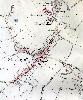
Stevington Inclosure Map of 1806
![Stevington inclosure map of 1806 [MA37]](/CommunityHistories/Stevington/StevingtonImages/Stevington inclosure map of 1806 [MA37]_100x61.jpg)
Stevington inclosure map of 1806 [MA37]
Ordnance Survey Maps of 1883

Park End in 1883
The Village in 1883

West End in 1883
Ordnance Survey Maps of 1901

Park End in 1901

The Village in 1901

West End in 1901
Ordnance Survey Maps of 1926
Park End in 1926

The Village in 1926
 West End in 1926