Shelton Before 1086

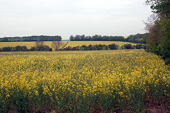
The view from Upper Dean Windmill looking towards Shelton May 2011
The Bedfordshire Historic Environment Record [HER] contains information on the county’s historic buildings and landscapes and summaries of each entry can now be found online as part of the Heritage Gateway website. A number of landscape features have been identified in the landscape around Shelton and may date to prehistory.
Some regular rectangular enclosure crop marks lie south-west of Mill View Farm, aligned either side of a straight double-ditched trackway, running south-west to north-east along a ridge [HER 12909]. The trackway is believed to be prehistoric, the location of the enclosures on either side of this trackway would suggest that they are related to it, and thus of a similar date. The record shows that no excavations have occurred on this site to support any of the dates so far assigned to these features. This is the problem with most of the crop marks in both Shelton and Dean. They have been designated as prehistoric because of a lack of dating evidence.
Other crop marks tentatively identified as prehistoric lie south-west of the village [HER 16569]. They comprisetwo adjacent rectangular enclosures and have been partly disturbed by areas of quarrying. Cropmarks. They are partly disturbed by areas of quarrying which is adjacent to the modern road.
A single small trapezoidal enclosure [HER 15023] is located to the SW of Three Shire Stone [HER 16624]. The stone marks the boundary between Bedfordshire, Huntingdonshire and Northamptonshire and lies just south of the B645 between Tilbrook [Huntingdonshire] and Hargrave [Northamptonshire]. It is the most northerly point in the county.
More crop marks lie north-west of Dean Mill. One group shows evidence for two roughly rectangular enclosures [HER 14007], the other block is a complex of rectangular enclosures, some of which may contain the sites of houses, with a small detached roughly square enclosure to the north-east [HER 14006]. A roughly D-shaped enclosure close to the site of some demolished 19th century agricultural buildings north-west of Lodge Farm may represent earlier prehistoric activity [HER 8162].
A scatter of roughly rectangular enclosures visible as crop marks west of Shelton Cottage [HER 570] may contain hut circles. A sherd of Romano-British pottery has been retrieved from the surface of the field. The site may represent and early Iron Age farmstead continuing into the Roman period. The site lies close to an extensive area of both single and grouped roughly rectangular enclosures along a ridge running south-west to north-east [HER 5197].
Finally, a sunken lined feature called Monks Pool is said to have lain north of the village and south of the B645 [HER 3931]. It is most likely to have been a well. A Roman silver coin called a denarius was found nearby in the early 1970s. There was also a local tradition that the feature was a bath used by monks. There is no evidence for the feature on the ground.