Potsgrove Maps
The map below shows Potsgrove on a tithe apportionment map of 1845 [MAT36]. To see a larger version please click on the image
![Potsgrove in 1845 [MAT36]](/CommunityHistories/Potsgrove/PotsgroveImages/Potsgrove in 1845 [MAT36]_231x300.jpg)
Potsgrove in 1845 [MAT36]
The maps below show Potsgrove on the 2nd edition Ordnance Survey 25 inches to the mile map of 1901. To see a larger version please click on the image.
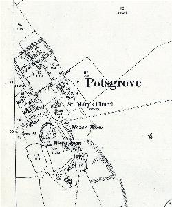
The eastern part of Potsgrove in 1901
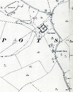
The western part of Potsgrove in 1901