Caddington Maps
The following maps are only a selection of those held at Bedfordshire Archives. To see a larger version of any map please click on the appropriate image.
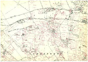
The map below is the map accompaying the inclosure award of 1800 [ref: MA46/1]. It shows the area of the village.
![Caddington Inclosure Map 1800 [MA46-1]](/CommunityHistories/Caddington/CaddingtonImages/Caddington Inclosure Map 1800 [MA46-1]_351x263.bmp)
The following three maps are the first three editions of the Ordnance Survey 25 inches to the mile maps. They are dated 1880, 1901 and 1926. They simply show the village.
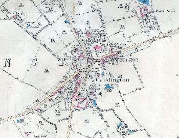
Caddington village in 1880
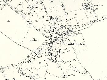
Caddington village in 1901
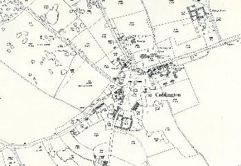
Caddington village in 1924
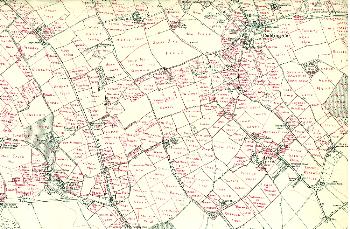
The two maps below are 6 inches to the mile Ordnance Survey maps annotated by the first County Archivist, Dr. George Herbert Fowler to show field names.
Caddington north
Caddington south