Prehistoric Stevington
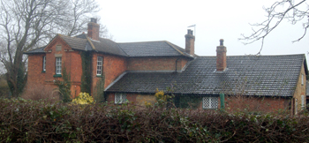
Tithe Farm December 2009
It is unusual, given that Stevington lies next to a major river, but there are no finds associated with the Old, Middle or New Stone Ages from the parish. It is assumed that rivers, at this remote epoch, were a major transportation system and so one would normally expect to have some remains nearby.
The earliest known feature in the Stevington landscape is a ring ditch. These are associated with the Bronze Age and the Bedfordshire Historic Environment Record states [HER 2790] that it lies north-east of Park End and close to the river: "an isolated ring ditch recorded by aerial photography. A small number of flint waste flakes have been found on the surface of the field". It should be noted that flint continued to be used long into the Bronze Age, alongside tools and weapons of bronze.
In common with most Bedfordshire parishes, a number of cropmarks have been identified through aerial photography in Stevington. It is assumed that these are prehistoric but, without excavation or finds from field walking, more precise dating is not possible. Sites identified are as follows:
- South-west of Tythe Farm and close to the A428 [HER 1845]: a cropmark showing a rectangular enclosure which does not correspond to either the modern or the pre-enclosure field system, and may be prehistoric in origin.
- North-west of Tithe Farm [HER 3120] An extensive group of cropmarks, indicating several large irregular enclosures thought to be prehistoric. The enclosures are located on a ridge between the headwaters of former watercourses.
- South-west of Duck End [HER 16526]: two small irregular enclosures and linear features, which are located on a slight rise.
- West of Pond Farm [HER 16527]: fragmentary cropmarks, including the north-east corner of a possible enclosure, which has mostly been covered by an ancient spinney and a semi-circular abutting drain, probably a former water course.
- West of Hart Farm [HER 16528]: cropmarks of a sub-rectangular enclosure that measures 60 metres by 40 metres.