Pegsdon Maps
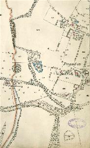
The map below is part of the inclosure map for Shillington made in 1817 [MA43]. To see a larger version please click on the image.
![Pegsdon in 1817 [MA43]](/CommunityHistories/Pegsdon/PegsdonImages/Pegsdon in 1817 [MA43]_339x300.jpg)
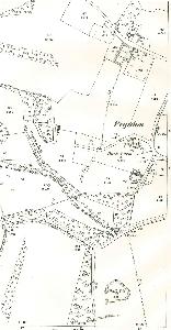
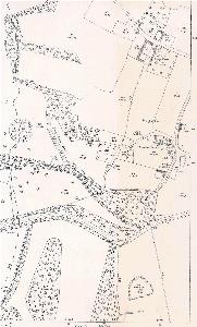
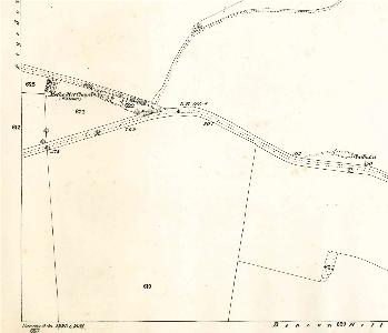
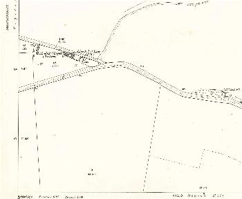
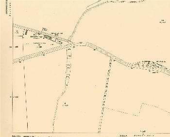
The maps below are the first three editions of the Ordnance Survey 25 inches to the mile maps. Again, to see a larger version pelase click on the image.
Pegsdon - west 1882
Pegsdon - west 1901
Pegsdon - west 1924
Pegsdon - east 1882
Pegsdon - east 1901
Pegsdon - east 1924