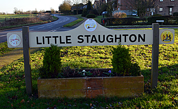
The Parish of Little Staughton in General
Jeanette Atkinson and Brenda Foster have been working on adding Community Archive pages for Little Staughton.
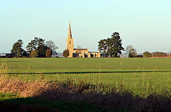
The view from Colmworth Road north to the church January 2017
Landscape
Little Staughton is a settlement in a fine position, which at the highest point in the south is 240 feet above ordinance datum. The village today is known to occupy the same areas as it did in medieval times [HER 17157]. There are distinct areas within the parish boundary known as Green, West and Top Ends. Dwellings line the main road that runs from Colmworth in the south for over a mile. The fine Norman church (All Saints’ formerly named Saintt Margaret’s) stands out alone on a high point; one common theory for the Church’s current isolation is that it is the result of the devastation of part of the village during the Black Death (1346-1353) where many people and dwellings were lost. Joyce Godber, in her History of Bedfordshire, reports that one-third of the Bedfordshire population died as a result of the first bubonic plague with the peak of deaths in March to August of 1349. However, isolated churches, such as that at Chellington, can simply indicate a shift of the village away from an area for other reasons such as courses of roads.
Towards the north end of the village the ground falls to 100 feet above ordinance datum, which means there is a steep hill, known as Spring Hill, at the northern end of the parish. Green End lies at the bottom of this large hill. Little Staughton has abundant fresh water springs hence the naming of Spring Hill – these form a chain across the ridge of the hill where the church sits and they then run down Spring Hill. When the water table is high these springs run freely.
Most of the parish stands on a solid, or underlying, geology of Oxford Clay Formation, a mudstone laid down in the warm, shallow seas of the Jurassic Period between 154 and 164 million years ago. Most of the village has a superficial geology of a type of diamicton called Oadby Member, laid down over the last two million years during numerous ice ages.
This ancient parish extends to over 1,700 acres; the majority is now arable land but there is some permanent grass used for livestock grazing. The parish boundary is little changed from medieval times when this parish was managed for its woods and rabbit warrens by the Knights Templar (a military order who also managed large, neighbouring estates in Pertenhall and Melchbourne).
During World War Two a substantial part of the village (20 buildings) at Top End was lost due to the building of a war time airfield (1942).
Name
The name Little Staughton is probably derived from:
- Stoc – Old English for place or secondary settlement or
- Stocc – Old English for an ‘enclosure made of stocks’
- Tun – Old English for enclosure, farmstead, village or estate.
[Source Cambridge Dictionary of Place-Names page 573; Ekwall, Dictionary of English Place-Names page 440, Mills, Dictionary of English Place-Names page 435; Mawer & Stenton, Bedfordshire Place-Names page 20]
Names that have been recorded are (Mawer and Stenton, Bedfordshire Place-Names):
- 1163 Stottum
- 1167, 1205 Stoctuna
- 1195, 1227 Stocton.
In some cases the qualifier of ‘little’ (Parva in latin) was added from 1247 and the following names were recorded:
- 1241, 1247 Sto(c)kton Parva
- 1302 Stottone
- 1346 Stoutone
- 1390-1490 Stowghton, Stoughton.
The following ancient place names have also been found within the parish; Walecote, Gerardesholmus, Robowell, Orescroft, Kynemare, Rodland, Wychercheshegges and Aldwic (The Victoria County History for Bedfordshire, Vol III, 1912).
Mawer & Stenton, in Bedfordshire Place-Names, note that a farm to the west of the Church (probably Hill Farm and named Churchehulle) was noted in 1247 and an area called Wickey was noted in 1208 (Wicheweia) and 1518 (Whikey). The name Wickey appears to be derived from Wic (dairy) and Weg (road to) and may mean ‘road to the dairy-farm’.
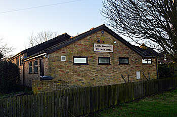
The Village Hall January 2017
Administrative History
Little Staughton is an ancient parish in the Stodden Hundred whose boundaries and districts have not changed since medieval times. The Hundred of Stodden was recorded as a Royal Hundred that belonged to The Crown until Charles I granted the Hundred to Gilbert North of East Greenwich [Kent] in 1629/30 (Victoria County History of Bedfordshire 1912, Vol III, p123). The name Stodden in Old English was Stoden and it means ‘to occupy a place’.
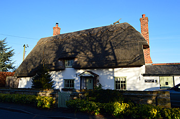
Walnut Tree Cottage January 2017
Population
Evidence of settlements from pre-history and Roman Britain exist but Little Staughton appears to have grown in size after the Norman Conquest. The Hearth Tax Return of 1671 (two shillings per annum for the privilege of owning a hearth or stove) indicates that the population of Little Stoughton at that time was an estimated 250 people, which was recorded as (Bedfordshire Historical Record Society Volume XVI, page 137):
- fifty-eight hearths and one possible forge (multiplied by 4.25 to give the total number of people)
- one household had five hearths
- one household had four hearths
- three households had three hearths and
- eight households were discharged from the tax by certificate (mostly widows).
The total population in Little Staughton during the 19th Century was as follows.
- 1801 - 272
- 1811 - 318
- 1821 - 406
- 1831 - 455
- 1841 - 485
- 1851 - 521
- 1861 - 572
- 1871 – 545.
In common with other rural areas, there was a decline in residents during the industrial revolution and during the time frame covering the two world wars of the 20th Century:
- 1881 - 569
- 1891 - 378
- 1901 - 267
- 1911 - 262
- 1921 - 246
- 1931 - 224
- 1951 – 218.
From the 1960s the population has been rising again:
- 1961 - 224
- 1971 - 302
- 1981 - 385
- 1991 - 434
- 2001 - 421
- 2011 – 440.