The Parish of Lower Gravenhurst in General
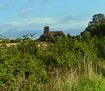
The church seen from the south September 2017
Landscape
Lower Gravenhurst stands on a solid geology of Gault Formation. This mudstone was laid down in warm shallow seas during the Cretaceous Period, between 99 and 112 million years ago. Around the church the soil is a diamicton called Lowestoft Formation, deposited in Ice Age conditions in the last two million years. In the north of the parish is an east-west band of head - a mixture of sand, gravel, silt and clay formed on glacial slopes. Lower Gravenhurst church is 195 feet above sea-level.
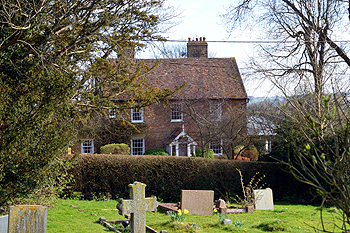
The former Rectory March 2014
Name
The Place Names of Bedfordshire and Huntingdonshire by A Mawer and Frank M Stenton was published in 1926 but is still the most scholarly study of the county’s place names and their origins. Gravenhurst may come from the Old English “grāfan-hyrst” meaning “wooded hill of the grove or thicket”. The name has had a number of different forms over the years:
- Crauenhest: 1086;
- Gravenherst: 1206-1504;
- Graveherst: 1213-1227;
- Gravenhurst: 1223 to date;
- Gravehurst: 1225-1302;
- Grauenhirst: 1227;
- Grauehirst: 1227-1260;
- Grauenhirste: 1232-1266;
- Grauenhyrste: 1232-1266;
- Grafhurst: 1240;
- Grauynherst: 1287;
- Cravenhurst: 1377;
- Grovenhurst: 1428.
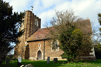
The church from the south March 2014
Administrative History
Lower Gravenhurst was an ancient parish in the Flitt Hundred. The civil parish was abolished in 1888 and combined with Upper Gravenhurst to form the new civil parish of Gravenhurst. The ecclesiastical parish was abolished in 1972 to create Upper with Lower Gravenhurst. The civil parish is bounded by: Campton and Chicksands to the north; Meppershall to the north-east; Shillington to the east with the former parish of Higham Gobion to the south; Silsoe to the west and Clophill to the north-west.
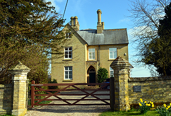
Rectory Farm House March 2014
Population
In 1086 both Upper and Lower Gravenhurst were held, as one manor which contained four villagers, three smallholders and four slaves - a total of eleven. As this number represents the heads of household, to get an idea of the total population it is probably necessary to multiply this figure by a factor of at least four suggesting a total population of somewhere around forty four. Censuses have been held each year in Britain since 1801, with the exception of 1941 when World War Two made it impracticable. The figures before 1891 are for Lower Gravenhurst and those for 1891 onwards for the civil parish of Gravenhurst.
- 1801: 48;
- 1811: 72;
- 1821: 63;
- 1831: 77;
- 1841: 50;
- 1851: 58;
- 1861: 60;
- 1871: 82;
- 1881: 79;
- 1891: 416;
- 1901: 364;
- 1911: 377;
- 1921: 351;
- 1931: 345;
- 1951: 387;
- 1961: 474;
- 1971: 541;
- 1981: 537;
- 1991: 504;
- 2001: 579;
- 2011: 595.