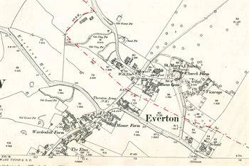
Everton Maps
The image below is part of the inclosure map for Everton. To see a larger version, please click on the image
![Everton about 1804 [MA73] note the top of the map is north-east](/CommunityHistories/Everton/Everton-Images/Everton-about-1804-MA73-note-the-top-of-the-map-is-north-east205x299.jpg)
Everton about 1804 [MA73], note the top of the map is north-east
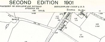
The maps below are second edition Ordnance Survey 25 inches to the mile maps of 1901. Again, to see a larger version, please click on the relevant image
The village of Everton in 1901, note the county coundary in red
The southernmost part of the village in 1901