Colesden Before 1086
As might be expected in an area close to a major river, in this case the Great Ouse, the local parishes contain a good deal of evidence of settlement before the Norman Conquest. The Bedfordshire Historic Environment Record [HER] details all these sites and find spots and is now on-line as part of the Heritage Gateway site. This article is taken from the various entries in the HER.
The earliest known evidence for human activity in Colesden is represented by a Neolithic or Bronze Age barbed and tanged flint arrowhead collected from a site near the settlement [HER 16209]. A number of cropmarks around Colesden have been identified as prehistoric but without material evidence a more exact date cannot be ascribed to them:
- HER 15045: cropmarks north-west of Lady Wood - ablock of sub-rectangular enclosures.
- HER 15046: cropmarks east of Colesden Hill Farm -a group of irregular enclosures, with outlying enclosures to the north and south. The marks are on a spur of higher ground defined by the loop of South Brook.
- HER 16747: two conjoined sub-rectangular cropmarks north of Begwary Brook which have been cut by a pipeline.
- HER 16749: a cropmark west of Palaceyard Wood of an isolated D- shaped enclosure. Part of another possible enclosure is located 150 metres to the east in the edge of a field.
- HER 16767: a cropmark of an isolated sub-rectangular enclosure south of Brook Farm, Begwary.

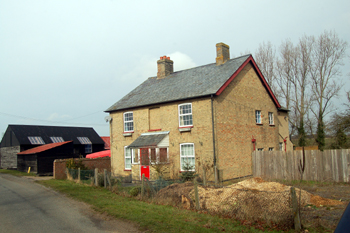
Brook Farm Begwary March 2010
Cropmarks and earthworks north of Colesden Road indicate a complex area of rectilinear enclosures, aligned approx north-east to south-west, with separate outlying areas to either end. Archaeological observation during the construction of a gas pipeline to the east of the cropmarks identified a small number of pits and ditches which produced pottery dating from the late 1st century BC to the 2nd century AD, making the site late Iron Age and Romano-British [HER 1834].
A Roman cremation urn and patera were discovered in Palaceyard Wood in the late 1960s [HER 5052] and a cropmark west of Bell Farm also appears to be Roman [HER 8812]. The site visit about 1978 and a small scatter of slag found near the area of cropmark. Five sherds of Roman pottery from different vessels were also found.
A dark patch in a field close to Palaceyard Wood was found in 1956 [HER 487] which contained a scatter of large stones, some of them flat, probably roof tiles, and unglazed pottery of late Saxon or early medieval date. The HER notes: " The finds' locations fall within small closes shown on the Enclosure Award Map of 1813, and probably represent the site of the deserted settlement of Roxton Wood End". It is thought that some of the pottery may also be Roman.