The Parish of Clifton in General
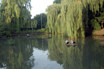
Clifton Pond August 2009
Landscape
Clifton is quite a flat, relatively low-lying parish. The lowest point of the parish, in the north, just east of Stanford Lane, near the River Ivel is only 104 feet above sea level, whilst, to the south, along Hitchin Road, the land rises to just under 200 feet. The church stands at about 150 feet above sea level
The underlying, or solid, geology throughout most of the village is a type of sandstone known as Woburn Sands Formation, laid down between 99 and 121 million years ago during the Cretaceous Period in warm, shallow seas. The superficial geology here is of glaciofluvial deposits, sand and gravel, laid down in the mid Pleistocene Epoch.
North and south of Shefford Road, however, and either side of New Road the underlying geology is Gault Formation - a mudstone laid down between 99 and 112 million years ago. At this point the superficial geology is a type of diamicton known as Lowestoft Formation.
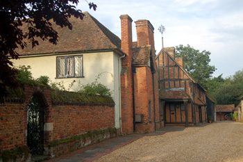
Clifton Grange August 2009
Name
Clifton may first mentioned be about 944. This was in an Anglo-Saxon charter. However, the charter was recorded by a monastic institution, about 1250 and may be a forgery of that date. The name is rendered as Cliftune, and has the meaning a settlement by a cliff or slope of a river. Other examples of this name show that the cliff did not need to be of Beachy Head proportions, or, indeed, any more than quite a high river bank. Other forms of the name include: Cliftone and Clistone, both in the Domesday Book of 1086 and Clyfton about 1350.
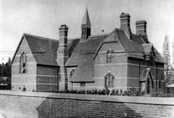
All Saints National School about 1900
Administrative History
Clifton is an ancient parish in the Clifton Hundred. The boundary between Clifton and Shefford used to be the River Ivel, meaning that a large part of what is now Shefford used to be part of Clifton and was known by such names at Clifton Fields and Shefford End.
The present boundary was established in 1933 is as follows. It is the southern arm and drain of the River Ivel running behind Clifton Fields to a point just east of Ashdown Road (which is in Shefford), south across the Clifton Road/Shefford Road and along the western boundary of SamuelWhitbreadUpperSchool, which is in Clifton. It then runs behind Southfields, in Shefford, in a dog-leg to Hitchin Road and the middle of the road then forms the boundary. To a point just south of the Business Park, where it runs east along the runways of Henlow Airfield, which is, thus partly in Clifton.
Clifton is bordered to the west by Shefford, to the south-west by Meppershall, to the south and east by Henlow, to a small part of the extreme north-east by Langford and to the north by Stanford in the parish of Southill. The main settlement lies in the centre and west of the parish with CliftonCaravanPark to the south and the sewage works in a long pan handle heading north-east.
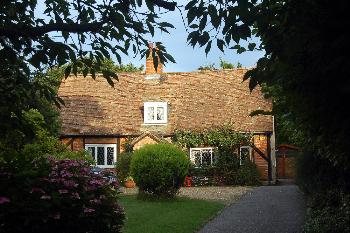
25 Church Street - Holly Cottage - August 2009
Population
The population of Clifton has grown greatly in the past two hundred years. There was a spike of 1,700 in 1871 which declined in the next ten years down to 1,458 and, due to the boundary change in 1933 a large part of the parish was lost to Shefford. The town went through another growth period in the late 1960s, the population nearly doubling in ten years from 1,354 in 1961 to 2,570 in 1971.
- 1801: 329;
- 1811: 399;
- 1821: 483;
- 1831: 664;
- 1841: 865;
- 1851: 1,053;
- 1861: 1,478;
- 1871: 1,700;
- 1881: 1,458;
- 1891: 1,374;
- 1901: 1,283;
- 1911: 1,223;
- 1921: 1,215;
- 1931: 1,309;
- 1951: 1,161;
- 1961: 1,354;
- 1971: 2,570;
- 1981: 2,693;
- 1991: 2,580;
- 2001: 2,729;
- 2011: 2,878.