Luton Landscape
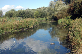
The River Lea at Leagrave Marsh September 2009
The ancient parish of Luton was easily the largest in area in the county. The parish contained a number of hamlets and came, altogether, to 15,434 acres, a figure stated by Volume II of The Victoria County History for Bedfordshire, published in 1908. The work states that 9,897 acres were arable land, 3,427 permanent grass (pastures and meadows) and 692 acres were woodland, the rest, of course, being housing. Crops grown included wheat, barley, oats and beans.
The geology, as one might expect in such a large area, is complex. The solid, or underlying geology, is of three main types, all of them variations of chalk:
- Holywell Nodular Chalk Formation mixed with New Pit Chalk Formation lies under the River Lea and the area immediately to the west as well as High Town, Park Town, Round Green, the northern part of New Town, the southern part of Leagrave and Stopsley Common. This was all laid down between 89 and 99 million years ago in the warm, chalk seas of the Cretaceous Period;
- Lewes Nodular Chalk Formation mixed with Seaford Chalk Formation lies under the area north and east of High Town, Farley Hill and Stockwood Park, Stopsley and the southern part of New Town. This formation was laid down between 84 and 94 million years ago;
- Zig Zag Chalk Formation lies under Limbury and the northern part of Leagrave. It was laid down between 94 and 99 million years ago.
The superficial geology also varies. Along the River Lea is a band of alluvium - mixed sand, gravel, silt and clay. Immediately to the west is an area of glacially deposited sand and gravel. These deposits are less than two million years old. North and east of High Town is a superficial geology is clay with flints formed 5 million years ago in the Quarternary and Neogene Periods. This also covers Farley Hill and Stockwood Park and the southern part of New Town. Round Green is covered in a mix of sand, gravel, silt and clay known as head and Limbury and Leagrave in glacially deposited sand and gravel from the last Ice Age.
Lying on the edge of the Chilterns most of Luton is, by Bedfordshire standards, quite high. Saint Mary's church is comparatively low at 360 feet above sea-level and Leagrave Marsh is about 380 feet. The Town Hall is nearly 390 feet above sea-level and the station is 375 feet. Luton Town football ground and Wardown Museum are around 390 feet. Waulud's Bank is about 400 feet above sea-level and the roundabout at Barton Road and Icknield Way stands at about 405 feet as does Saint Andrew's church.
Someries Castle is about 515 feet above sea-level and the airport terminal about 525 feet. The Jolly Toper at Round Green is 535 feet above sea-level as is Stockwood Discovery Centre. Bradgers Hill gets up to just over 560 feet above sea-level.