The Community of Girtford in General
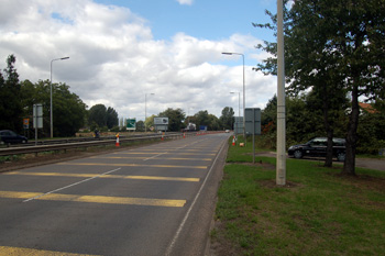
The A1 at Girtford August 2010
Landscape
Girtford is in rather flat, low-lying country, around 80 feet above sea-level on average. The solid, or underlying, geology is a type of mudstone called Oxford Clay, laid down between 154 and 164 million years ago in the warm, shallow seas of the Jurassic Period. The superficial geology comprises river terrace deposits, as one might expect so close to two major rivers, made up of sand and gravel.
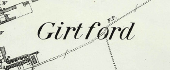
The name on a map of 1901
Name
Girtford is first recorded in 1247 and the name means "gravel ford". The name has undergone a number of variations over the years:
- Grutford: 1247-1276;
- Grotford: 1247;
- Grutteford: 1276-1338;
- Gretford: 1291;
- Grotteford: 13th century;
- Gyrtford: 13th century - 1629;
- Gretteford: 13th century;
- Gritteford: 1407;
- Gyrford: 1634 - c. 1750;
- Gurford: 1634 - c. 1750.
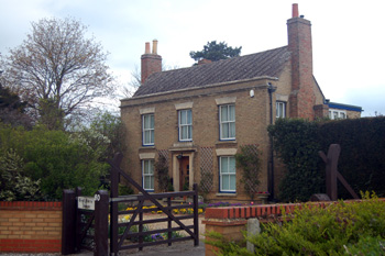
80 London Road - West Farmhouse - March 2010
Administrative History
Girtford was always a hamlet in the ancient parish of Sandy. During the 20th century the two settlements grew together and since about 1910 Girtford is, effectively, just a part of the town of Sandy, with no clear boundaries. For the purposes of these pages Girtford has been defined as the roughly triangular area bounded by the A1 to the west, Saint Neots Road to the east and Bedford Road to the south.