The Community of Kempston Hardwick in General
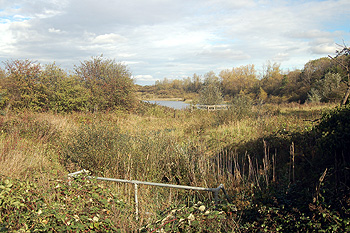
Countryside at Kempston Hardwick October 2011
Kempston Hardwick is a hamlet which fell in three civil parishes in the space of 41 years. Until 1896 it was part of the ancient, and large, parish of Kempston. In that year Kempston was divided into two civil parishes, one for the urban area and a new parish of Kempston Rural for the various hamlets around it. Kempston Hardwick was part of Kempston Rural. Then, in 1937, the new civil parish of Stewartby was formed around the brick making community which had grown up in Wootton and Kempston Rural and at that time Kempston Hardwick was transferred to the civil parish of Stewartby, where it remains.
Landscape
Kempston Hardwick has a solid, or underlying, geology of a type called Peterborough Member. This is a mudstone laid down between 159 and 164 million years ago in the warm, shallow seas of the Jurassic Period. The soil is mostly clay but a narrow band of a mixture of clay, silt, sand and gravel laid down in the last two million years by water action called head runs along Manor Road and to either side, south-east from the station. There is also an area of head to the north-east including the junction with Woburn Road.
Lying, as it does, in the clay vale means that Kempston Hardwick is both flat and quite low-lying. The Chimney Corner Public House stands at 125 feet above sea-level. Kempston Hardwick Station is ten feet lower and the junction of Woburn Road and Manor Road is 111 feet above sea-level.
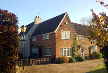
Moat House November 2007
Name
The name Kempston was first recorded in 1060 as Kemestan, in the Domesday Book it is Camestone. It is first recorded in its modern form in 1247. The name is not an easy one to determine. The second syllable is the Old English “tun” meaning farm or settlement. It has been suggested [Bedfordshire Place Names published 1926, page 76] that the first element may relate to the bend in the River Great Ouse and come from the Celtic “cambo” meaning crooked, thus “farm in the crook of the river”.
Kempston Hardwick is not mentioned in the Domesday Book of 1086. It was first recorded in 1276 as Hardwyke, being Herdewyk by Kemeston in 1334 and Kempston Hardewik in 1485; the word Hardwick means "sheep farm".
The name Kempston has undergone a number of variations over the years as the following shows:
- Kemestan 1060-1199;
- Cœmbestun c.1060;
- Cæmbestune (1077);
- Camestone (1086-1200);
- Canbestuna (1124-1128);
- Kembeston (1176-1402);
- Kemeston (1189-1332);
- Kamistuna: 1195;
- Camestun: 1195;
- Chemiston: 1199;
- Cemeston: 1199;
- Cambesdon: 1201;
- Kimbeston: 1201;
- Cambeston: 1236;
- Kemston: 1236-1349;
- Kembestun: 1237-1253;
- Kemestun: 1241;
- Kemyston: 1242;
- Kempston: 1247 onwards;
- Kempeston: 1276-1306;
- Kemmeston: 1276;
- Camston: 1328;
- Cameston: 1332
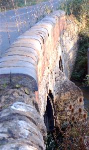
Hardwick Bridge
Administrative History
Kempston Hardwick is a hamlet which fell in three civil parishes in the space of 41 years. Until 1896 it was part of the ancient, and large, parish of Kempston. In that year Kempston was divided into two civil parishes, one for the urban area and a new parish of Kempston Rural for the various hamlets around it. Kempston Hardwick was part of Kempston Rural. Then, in 1937, the new civil parish of Stewartby was formed around the brick making community which had grown up in Wootton and Kempston Rural and at that time Kempston Hardwick was transferred to the civil parish of Stewartby, where it remains.