Kempston Hardwick Maps
To see a larger version of the maps, please click on the appropriate image.
Inclosure Maps
![Kempston Hardwick in 1804 [MA18]](/CommunityHistories/KempstonHardwick/KempstonHImages/Kempston Hardwick in 1804 [MA18]_144x301.jpg)
The inclosure map of 1804 [ref: MA18]
![Kempston Hardwick in 1847 [X1-25]](/CommunityHistories/KempstonHardwick/KempstonHImages/Kempston Hardwick in 1847 [X1-25]_173x300.jpg)
Revision of 1847 of the inclosure map [ref: X1/25]
Ordnance Survey Maps
These are Ordnance Survey 25 inches to the mile maps, the 1st edition of 1883 and the 2nd edition of 1901.
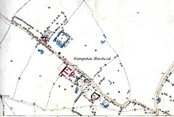
Ordnance Survey 1st Edition Map

Ordnance Survey 2nd Edition Map