Greenfield Maps
The following maps are only a selection of those held at Bedfordshire Archives. The map below shows Silsoe in 1828 and is taken for a map prepared for Amabel, 1st Countess Grey [ref: L33/9]. The map also shows the villages of Silsoe, Flitton, Clophill, Pulloxhill, Upper Gravenhurst, Lower Gravenhurst and Higham Gobion. To see a larger version, please click on the image.
![Greenfield in 1828 [L33-9]](/CommunityHistories/Greenfield/GreenfieldImages/Greenfield in 1828 [L33-9]_223x300.jpg)
Greenfield in 1828 [ref: L33/9]
The two maps below are from the Ordnance Survey 25 inches to the mile maps showing the village. The first edition was published in 1881, the second edition in 1901. Again, to see a larger version, please click on the corresponding image.
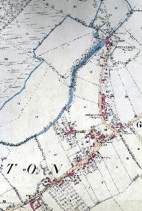
Greenfield in 1881
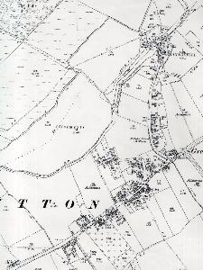
Greenfield in 1901