Broom Maps
The following maps are only a selection of those held at Bedfordshire Archives. To see a larger version of each map, please click on the relevant thumbnail
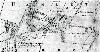
Inclosure Map of 1800 [ref: W2/26]
1st Edition 25 Inches to the Mile Ordnance Survey Map
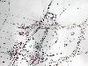
Broom north and central 1884
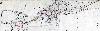
Broom south 1881
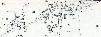
3rd Edition 25 Inches to the Mile Ordnance Survey Map

Broom north and central 1926
Broom south 1926