Brogborough Maps
The maps below are inclosure maps for Rodgmont and Husborne Crawley showing the area of the current parish of Brogborough. To see larger versions please click on the relevant image
![The part of Husborne Crawley now in Brogborough about 1799 [MA75]](/CommunityHistories/Brogborough/Brogborough-Images/The-part-of-Husborne-Crawley-now-in-Brogborough-about-1799-MA75220x299.jpg)
Part of Husborne Crawley, now in Brogborough about 1799 [ref: MA75]
![The part of Ridgmont now in Brogborough about 1803 [MA15]](/CommunityHistories/Brogborough/Brogborough-Images/The-part-of-Ridgmont-now-in-Brogborough-about-1803-MA15272x299.jpg)
Part of Ridgmont now in Brogborough about 1803 [ref: MA15]
The images below are second edition Ordnance Survey 25 inches to the mile maps of 1901; again, to see a larger version please click on the relevant image
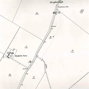
Brogborough Highfields Farm in 1901
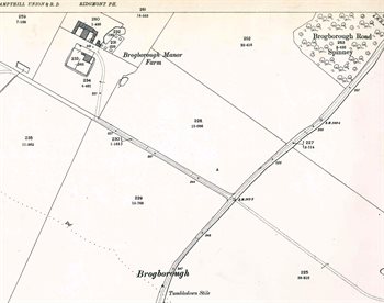
Brogborough Manor Farm in 1901
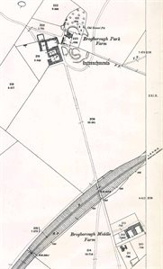
Brogborough Park and Middle Farms in 1901