Aley Green Maps
The following maps are only a selection of those held at Bedfordshire and Luton Archives and Records Service.
The Ordnance Survey 6 inches to the mile map below was annotated by the first County Archivist, Dr. George Herbert Fowler to show local field names - click on the image to see a larger version.
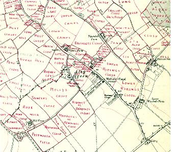
Map showing field names - Aley Green [ref: MC3/3/1/17]
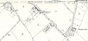
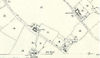
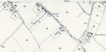
The maps below are Ordnance Survey 25 inches to the mile maps - 1st edition 1880, 2nd edition 1901 and 3rd edition 1924. Again, to see a larger version please click on the image.
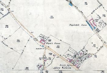
Aley Green in 1880 - north
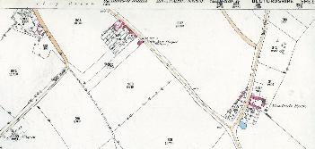
Aley Green in 1880 - south
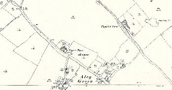
Aley Green in 1901 - north
Aley Green in 1901 - south
Aley Green in 1924 - north
Aley Green in 1924 - south