The Community of Aley Green in General
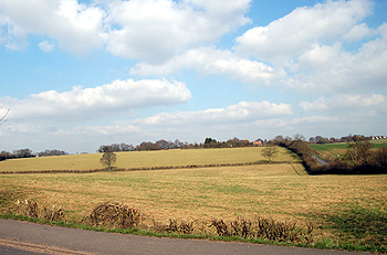
Countryside at Aley Green, March 2012
Landscape
Aley Green lies at the north-eastern end of the Chiltern Hills. This is a chalk landscape and chalk is the underlying geology. This chalk is of three distinct types. A narrow strip beneath the line of Mancroft Road is of a type known as Holywell Nodular Chalk Formation and New Pit Chalk Formation – laid down between 89 and 99 million years ago in the Cretaceous Period in warm shallow seas. This is surrounded by two other types of chalk – Lewes Nodular Chalk Formation and Seaford Chalk Formation, laid down between 84 and 94 million years ago and West Melbury Marly Chalk Formation laid down between 94 and 99 million years ago. Overlying this chalk solid geology is a subsoil of clay with flints.
As one might expect, on the slopes of the Chilterns, Aley Green is quite elevated for a place in Bedfordshire. The cemetery stands at around 493 feet above sea -level
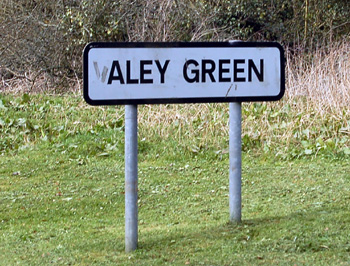
Aley Green sign, March 2012
Name
The name is not an easy one to interpret. The first element may, perhaps, derive from the Scandinavian personal name Áli.
Site of the old works in Aley Green, March 2007
Administrative History
Aley Green is a hamlet in the civil parish of Caddington. It is likely that the original settlement of Aley Green occurred through clearing woodland, perhaps by squatters seeking land and dwellings outside the Manor of Caddington at some time in the early Middle Ages.
The green is referred to in the 17th century but by the late 18th century it had gone. It may well have occupied the triangular area created by the junction of Piper's Lane and Mancroft Road running south.
Like the rest of the civil parish Aley Green has been in both Bedfordshire and Hertfordshire in its time. The most recent boundary change occurred in 1965 [ref: CDR75] when the hamlet was brought entirely into Bedfordshire. Up to that point two segments of the hamlet lay in Hertfordshire. The first segment was enclosed by a rough rectangle running: Mancroft Road - Markyate Road - the footpath leading from the bend of Piper's Lane to Markyate Road - the footpath from the bend in Piper's Lane to Mancroft Road at the north-west corner of the Methodist Church. The second segment included the properties on the west side of Piper's Lane including Rose Cottage, Easter Cottage, Sunnyside and Boundary Cottage. Both these segments are now inside Bedfordshire.