The Parish of Tilsworth in General
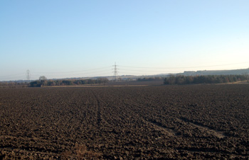
View from Dunstable Road towards Houghton Regis December 2008
Landscape
Tilsworth is a small parish. Volume III of The Victoria County History for Bedfordshire was published in 1912. At this date the parish comprised of 1,246 acres. 453 acres, 2 roods were arable farmland, 729 acres, 2 roods were permanent grass and woods and plantations accounted for 14 acres.
The land slopes in a north-south direction. The highest point in the parish, at 441 feet above sea level lies in the north of the parish and the lowest point, 310 feet by a brook at the south of the parish. The church is 360 feet above sea-level, Bull Farmhouse is 355 feet and Blackgrove Wood averages around 320 feet above sea-level.
The solid, or underlying, geology is mostly a mudstone called Gault Formation. This was laid down in warm, shallow seas in the Cretaceous Period between 99 and 112 million years ago. The higher ground to the north and Blackgrove Wood to the south, however, have a solid geology called Upper Greensand Formation, despite its name this is a clay mudstone laid down between 94 and 112 million years ago.
Mostly the soil matches the bedrock but there is a dry valley running north to south filled with a mixture of sand, gravel, clay and silt called head. On the higher ground are patches of glacial till.
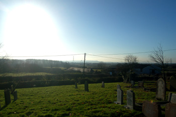
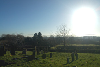
View from Tilsworth church towards Blackgrove and Stanbridge Woods December 2008
Name
Tilsworth is first mentioned in the Domesday Book of 1086. It is not absolutely certain what the name means but both The Oxford Dictionary of English Place Names and Bedfordshire Place Names by A.Mawer and F.M.Stenton agree that the best guess is Thyfel's worth - Thyfel being an Anglo-Saxon name and worth meaning enclosure or homestead. The name has undergone a large number of variations over the years:
- Pileworde (1086);
- Thuleswrthe (1202);
- Tillesworde (1219);
- Tilesworth (1227);
- Tuillesworth (1227);
- Tulleswrth (1240-1247);
- Tiueleswrth (1247);
- Tilleswurth (1247);
- Tyuelesworth (1247);
- Tulesworth (1297-1346);
- Tulleworth (1276);
- Tullesworth (1276-1291);
- Tulisworth (1276);
- Teulesworth (1276);
- Thulesworth (1276-1287);
- Tyllesworth (1276-1497);
- Tillesworth (1276-1497);
- Tyllisworth (1287-1428);
- Tyllysworth (1287-1428);
- Tylysworth (1390-1392);
- Tildesworth (c.1440)
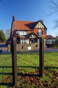
Tilsworth stocks December 2008
Administrative History
Tilsworth is an ancient parish. It is bordered by Stanbridge to the west, Totternhoe to the south, Houghton Regis to the south and south-east, Chalgrave to the east, Hockliffe to the north and Eggington to the north-west.
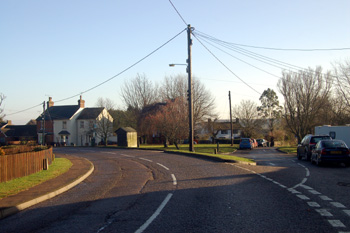
Dunstable Road and Dickens Lane December 2008
Population
The Hearth Tax of 1671 (transcribed in Bedfordshire Historical Records Society Volume 16 in 1934) records 24 dwellings in Tilsworth for a total of 44 hearths. It has been estimated that this represented a population of about 106. The largest number - seven - were in the house of John Quincey. One persons in the parish "received constant alms".
Volume 81 published by Bedfordshire Historical Records Society (2002) is devoted to returns made during the episcopal visitations to the county by the Bishop of Lincoln in the early 18th century, edited by former County Archivist Patricia Bell. One of the questions asked was the number of families in the parish; the various responses were as follows:
- 1706: 20 families;
- 1709: 24 families "souls 150";
- 1712: 25 families;
- 1717: 26 families;
- 1720: 25 families
Census returns enable us to chart the population figures in Tilsworth from 1801; the drop in population around the turn of the 19th and 20th centuries is measured in many villages as jobs on the land decreased, forcing a move to towns:
- 1801: 195;
- 1811: 206;
- 1821: 246;
- 1831: 275;
- 1841: 311;
- 1851: 337;
- 1861: 438;
- 1871: 330;
- 1881: 250;
- 1891: 219;
- 1901: 218;
- 1911: 206;
- 1921: 168;
- 1931: 188;
- 1951: 227;
- 1961: 250;
- 1971: 283;
- 1981: 323;
- 1991: 337;
- 2001: 360;
- 2011: 331.
View over Manor Farm and Blackgrove Wood December 2008