Swineshead Maps
The following maps are only a selection of those held at Bedfordshire Archives. To see a larger image please click on the relevant thumbnail
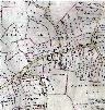
The Swineshead inclosure map of 1808 [ref: MA97/2]shows the village as being remarkably similar to today - buildings are coloured in black. To see a larger image please click on the thumbnail
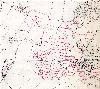
The second edition Ordnance Survey 25 inches to the mile map of 1901 again shows a similar village to today, again, click on the thumbnail to see a larger image
6 inch Ordnance Survey 2nd edition 6 inches to the mile map of 1902 annotated by a former County Archivist to show field names