The Community of Lower Caldecote in General
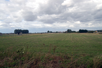
The flatness that is Lower Caldecote August 2010
Landscape
Lower Caldecote lies on the Great North Road (the modern A1), with the exception of Manor Farm, all the houses lie on the west side of the road. The hamlet is small comprising just the Great North Road itself and The Grange, a modern development built on the site of the large house of that name. The eastern half of the hamlet comprises sand and gravel works and their attendant quarries, most now filled with water. The River Ivel forms the eastern boundary of the hamlet (except for a bulge to take in the sand and gravel works) and of the parish of Northill generally. The land is flat and low lying, around 80 to 90 feet above sea level.
The existence of sand quarries means that it comes as no surprise that the superficial geology is a mixture of sand and gravel known as river terrace deposit. The solid, or underlying, geology, however, is a clay mudstone known as Oxford Clay Formation, laid down between 154 and 164 million years ago in the shallow seas of the Cretaceous Period.
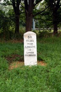
Lower Caldecote milestone July 2007
Name
The hamlet of Caldecote was first recorded in 1197 with Lower Caldecote first recorded in 1351. The name Caldecote means "cold cottages" due, no doubt, to the exposed position on the flat countryside.
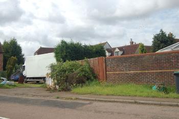
Site of the former King's Head July 2007
Administrative History
Lower Caldecote has always been a hamlet in the ancient parish of Northill.