Lower Caldecote Maps
The following maps are only a selection of those held at Bedfordshire and Luton Archives and Records Service.
The map of Lower, or Nether, Caldecote below is taken from the Northill Inclosure map of 1783 [MA2]. Note that the top of the map is west rather than north. To see a larger version, please click on the image.
![Nether Caldecote in 1783 [MA2]](/CommunityHistories/LowerCaldecote/LowerCaldecoteImages/Nether Caldecote in 1783 [MA2]_322x300.jpg)
Nether Caldecote in 1783 [MA2]
The maps below are from the first three editions of the Ordnance Survey 25 inches to the mile map for the area. Again, to see a larger version, please click on the relevant image.
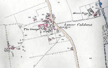
Lower Caldecote in 1884
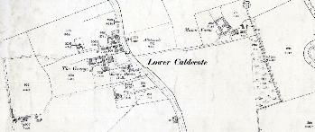
Lower Caldecote in 1901
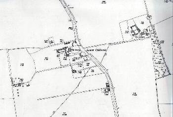
Lower Caldecote in 1926