The Parish of Cockayne Hatley in General
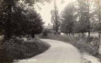
Village Road, Cockayne Hatley c.1920 [ref: Z1306/55/6]
Cockayne Hatley is a small parish in the north-eastern corner of Bedfordshire, sitting on the border with Cambridgeshire. Bedford is 13 miles to the west and Cambridge sits the same distance to the north east. Biggleswade lies six miles to the south west. It is bounded by the Bedfordshire parishes of Potton and Wrestlingworth to the west and south and the Cambridgeshire parishes of Gamlingay and Hatley St George and Tadlow to the north and east. The parish boundaries appear to follow old field boundaries rather than natural features.
The village of Cockayne Hatley sits in the centre of the parish, which mainly consists of the Cockayne Hatley estate. The main part of the settlement is centred on Home Farm (formerly Cockayne Hatley House) and Village Farm, together with the church and the rectory. The Victoria County History, published in 1908, describes Cockayne Hatley House as ‘not of much architectural interest, and its exterior is comparatively modern’. It goes on to say that the site is older with parts of the former house covered by modern additions. The newer housing in the village is mostly around Village Farm, to the south-east of the original core of the settlement. Toi the north lies Wood Farm, and to the south-west Church Farm.
Landscape
The Victoria County History (VCH) describes the parish as being 1,174 acres in extent, with 777 acres of arable land, 283 of permanent grass and 210 of woods and plantations. The soil is strong clay with a clay subsoil. The heavy boulder clay is suitable for the manufacture of bricks and local field names, such as ‘Brick Clamp/Camp Close’, indicate that brickmaking was probably carried out in the area.
The centre of the village is 61 metres (200 feet) above sea level. This rises to 91 metre (299 feet) in Cockayne Hatley Wood which is located to the north.
The main crops grown at the time the VCH was compiled were wheat, turnips, barley, peas, and beans, with the main agricultural area lying to the south of the parish. In the 20th century the parish became notable for the extensive Cox’s Orange Pippin apple orchards planted by COPO Ltd.
Name
A draft parish survey compiled by the Conservation Section of the Planning Department of Bedfordshire County Council in 1976 [ref: PL/AC2/24], states that the name Hatley comes from ‘Haeda’s leah’ indicationg a well wooded area, originally a Saxon settlement in a forest clearing. Local field names, such as Wrestlingworth Dane, Willow Dane and Upper, Middle and Little and Oak Closes seem to confirm this.
The name Hettenleia or Haettenleia first appears in two Anglo-Saxon charters granting land to Ramsey Abbey, circa 960. The 1086 Domesday Survey records two manors of Hatelai. Over the centuries it has been known as Bury Hatley, Hatley Port (the suffix reflecting the name of the Port family, who owned the manor in the 13th century) and eventually Cockayne Hatley after the Cockayne family who held the manor for over 300 years from the early 15th century onwards.
Bedfordshire Archives catalogue descriptions will record the name as listed on the document and can be found by searching for the index term ‘Cockayne Hatley’.
Administrative History
Cockayne Hatley was originally part of the half hundred Wenslow, but by the 13th century this had been absorbed into the Hundred of Biggleswade. From 1894 until 1974 the parish was administered as part of the Biggleswade Rural District. From 1974 to 2009 it was included in Mid Bedfordshire District Council, and it is now administered by the unitary authority Central Bedfordshire Council. At the parish level, the civil parishes of Cockayne Hatley and Wrestlingworth were amalgamated to form Wrestlingworth and Cockayne Hatley civil parish.
There is no enclosure award for Cockayne Hatley. Enclosure was complete by 1826 and the parish survey concludes that it was probably a simple process as one man owned all the land in the parish.
Charities
According to the Victoria County History the widow of Sir Patrick Hume, who died in 1627, charged certain lands with a payment of £3 per year. This was to be used to pay £1 to the rector for two sermons a year, one at Lady Day and the other Michaelmas; £1 was to go to the poor and £1 to be used for repairs to the church.
The Churchwardens’ account book, reference P104/5/1, includes a copy of Lady Hume’s will setting out bequests to the poor. Charity Commissioner files for Lady Hume, dated 1901-1951, can be found under reference CHAR52/1.
Population
The number of households recorded in the Domesday Book for Cockayne Hatley was 29. To gain an idea of the total population this figure should be multiplied by at least four to account for their dependents. This gives a total of around 120. However, 16 of these households belonged to an estate granted to the Countess Judith which was apparently absorbed into Potton at an early date, leaving only 13 households, or around 50 to 60 people, in Cockayne Hatley itself.
Census returns since 1801 show a small averaging around 100. No census was taken in 1941 due to the Second World War and there are no figures after 1981 as in 1985 the civil parish was amalgamated with Wrestlingworth.
- 1801: 102
- 1811: 110
- 1821: 117
- 1831: 125
- 1841: 99
- 1851: 112
- 1861: 126
- 1871: 124
- 1881: 107
- 1891: 104
- 1901: 84
- 1911: 110
- 1921: 87
- 1931: 84
- 1951: 116
- 1961: 122
- 1971: 85
- 1981: 78