Campton Maps
To see larger images of the maps below please click on the appropriate image. The inclosure map dates from 1797 [MA9] whilst the other maps are Ordnance Survey 25 inches to the mile scale, the 1st edition dating from 1883 and the 2nd edition from 1901.
![Campton in 1797 [MA9]](/CommunityHistories/Campton/CamptonImages/Campton in 1797 [MA9]_350x263.jpg)
Campton in 1797 [MA9]
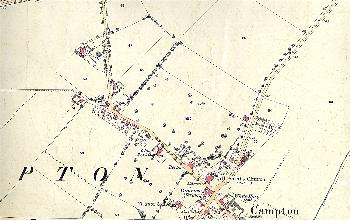
The northern part of the village in 1883
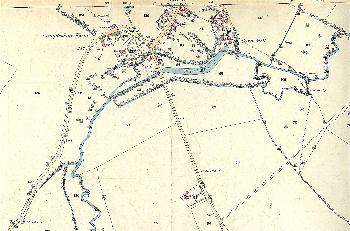
The southern part of the village in 1883
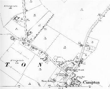
The northern part of the village in 1901
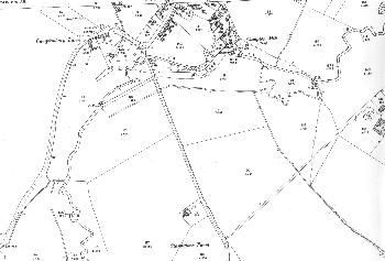
The southern part of the village in 1901