The Parish of Campton in General
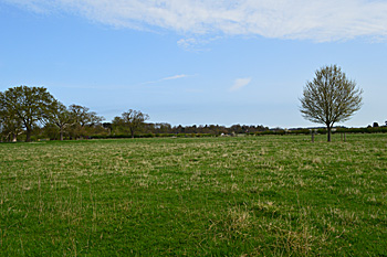
Looking from the school towards Chicksands April 2015
Landscape
The underlying geology for most of the village is a type of sandstone called Woburn Sands Formation laid down between 99 and 121 million years ago in the warm, shallow seas of the Cretaceous Period. South-east of the River Hit, around Campton Road and underneath much of Gravenhurst Road the underlying geology is Gault Formation, a mudstone laid down between 99 and 112 million years ago.
The soil is mostly either sand or clay depending on the underlying geology. Some areas of the village have a soil called Head, a mixture of gravel, sand, silt and clay formed up to two million years ago.
Campton is a comparatively low-lying parish. The church stands at around 150 feet above sea-level and much of the parish is within ten feet of this either way.
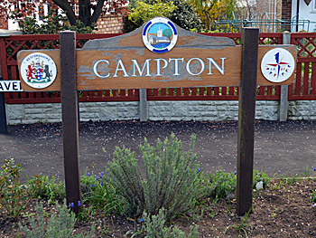
Name
It is not certain where the name Campton originated from. A. Mawer and F. M. Stenton's seminal 1926 volume on the place names of Bedfordshire and Huntingdonshire suggests that it originates from the name of a long forgotten nearby stream or river, likely called the Camel or Camelar. A number of variations in name have appeared over the centuries:
- Chambeltone: 1086;
- Camelton: c. 1150-1548;
- Kamelton: c.1150-1548;
- Kamerton: 1152-8;
- Kametona: 1155;
- Cameltun: c.1172-1180;
- Gamelton: 1177-1291;
- Gamelinton: 1276;
- Cameletone: 1316;
- Camulton: 1334;
- Cambelton: 1356;
- Gameleton: 1393;
- Camulton: 1400;
- Campton: 1526;
- Camelton: 1550;
- Cambleton: 1610
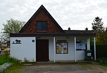
Campton Village Hall April 2015
Administrative History
Campton is an ancient parish and included in the township of Shefford. Shefford became a separate civil parish in 1866 and a separate ecclesiastical parish in 1903. A civil boundary change for Campton took place in 1933, and on 1st April 1985 it became part of the modern parish of Campton and Chicksands. Further boundary changes to the modern parish occurred in 1993.
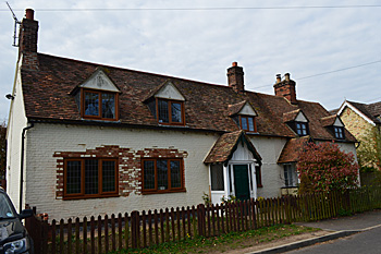
33 and 35 Rectory Road April 2015
Population
The Domesday Book of 1086 records that eight people lived in Campton. These would have been heads of household so the number needs to be multiplied by a factor of at least four. This suggests a population of just over thirty making the settlement a small one even by the standards of the day.
Census figures from 1801 to 2011 show changes set out below. The population remained fairly stable for around 150 years, but it more than quadrupled between 1961 and 1971, a rather staggering leap given the short time frame. Figures from 1991 onwards include the inhabitants of Chicksands.
- 1801: 316;
- 1811: 324;
- 1821: 410;
- 1831: 449;
- 1841: 501;
- 1851: 548;
- 1861: 529;
- 1871: 570;
- 1881: 555;
- 1891: 448;
- 1901: 437;
- 1911: 415;
- 1921: 396;
- 1931: 442;
- 1951: 381;
- 1961: 358;
- 1971: 1,602;
- 1981: 1,391;
- 1991: 2,293;
- 2001: 1,390;
- 2011: 1,699.