The Parish of Eastcotts in General
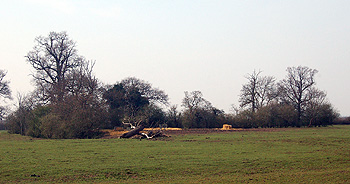
Countryside at Cotton End March 2011
Landscape
Eastcotts lies in the flood plain of the River Great Ouse, except near the boundary with Old Warden at the south-east where it lies on a clay escarpment. It is comparatively low-lying, less than a hundred feet below sea level in places in the north of the parish. The highest point near the Old Warden boundary is around 250 feet above sea level.
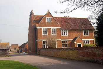
253 and 254 Old Harrowden Road March 2011
Name
The name is first found in 1220 as Cotes. Variations include Estcotes in 1240 and 1393, Escotes in 1382 and Escotts in 1780. The word cote simply means cottage so Eastcotts means east cottages. There was part of Wilshamstead once known as Westcotts
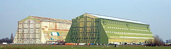
The sheds at RAF Cardington March 2011
Administrative History
Eastcotts is s relatively new parish. It was formerly a township comprising three hamlets, Cotton End, Fenlake and Harrowden, in the ancient parish of Cardington. It was made a separate civil parish in 1866 but remains part of the ecclesiastical parish of Cardington because there is no Anglican church in the parish. The parish lost Fenlake in 1968 when it was transferred to Bedford but gained the settlement of Shortstown, which began in 1916.
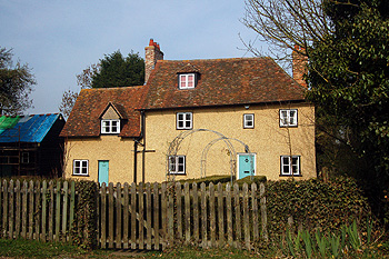
Manor Farmhouse Cotton End March 2011
Population
The combined population of the two main manors at Harrowden listed in the Domesday Book of 1086 was twenty villagers, fourteen smallholders and two slaves – thirty six people. Of course, these were just the heads of household. If one multiplies this figure by a fairly conservative factor of four to allow for wives and children one gets a population for the area of a hundred and forty four, making it quite well populated by the standards of the day. It is likely that these two manors included not just Harrowden but also what became Shortstown from 1917, Fenlake and Cotton End.
The more modern population of Eastcotts has been traced from census information as follows;
- 1801: 504;
- 1811: 513;
- 1821: 588;
- 1831: 710;
- 1841: 859;
- 1951: 881;
- 1861: 847;
- 1871: 798;
- 1881: 713;
- 1891: 830;
- 1901: 871;
- 1911: 848;
- 1921: 2,065;
- 1931: 1,660;
- 1951: 3,675;
- 1961: 2,137;
- 1971: 2,250;
- 1981: 1,707;
- 1991: 1,853;
- 2001: 3,188;
- 2011: 3,239.
Eastcotts has been bigger than Cardington since 1831. The big jump in population in 1921 is due to the building of Shortstown from 1917 to house workers in the airship construction industry. The fall of 1931 is probably due to the termination of the Royal Airship Works following the destruction of the R101 in October the previous year. The drop from 1951 to 1961 is probably due to the end of National Service call up in 1960 reducing numbers at RAF Cardington. At the time of writing [2011] a large amount of building is going on in Shortstown around the former RAF base which will no doubt mean another significant rise in population figures.