Chaul End Maps
The following maps are only a selection of those held at Bedfordshire Archives.
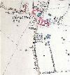
To see a larger image of this Ordnance Survey 25 inch to the mile 1st edition map of 1880 please click on the thumbnail above
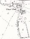
To see a larger image of this Ordnance Survey 25 inch to the mile 2nd edition map of 1901 please click on the thumbnail above
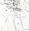
To see a larger image of this Ordnance Survey 25 inch to the mile 3rd edition map of 1924 please click on the thumbnail above