The Village of Beeston in General
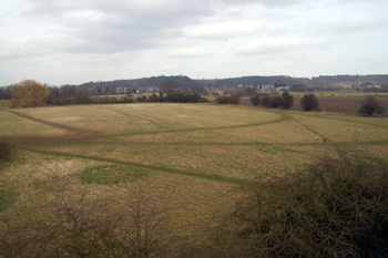
The view from Beeston towards Sandy Heath, March 2010
Landscape
Beeston lies around the Great North Road, the modern A1. The land is low lying and flat and is bounded to the east by the River Ivel; Beeston Green lies at approximately 80 feet above sea-level.
As would be expected near a river, the superficial geology is made up of river terrace deposits - sand and gravel formed up to two million years ago. The solid, or underlying, geology is Oxford Clay, a mudstone laid down between 154 and 164 million years ago in the Jurassic Period when this part ofthe World was under warm, shallow seas.
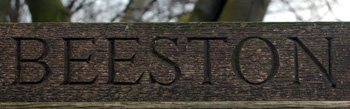
Beeston sign
Name
Beeston was first recorded in the Domesday Book of 1086. The name is open to interpretation, there are a number of Beestons in England and The Oxford Dictionary of English Place Names gives a generic meaning of "farm where the bent grass grows". Of the Bedfordshire Beeston, A. Mawer and D. M. Stenton in their Place Names of Bedfordshire and Huntingdonshire of 1926 give a suggestion of "farm of or in the bend of the river" as the settlement lies in a bend of the River Ivel. The name has undergone a number of variations over the years with the first occurrence of the current form occurring as long ago as 1219:
- Bistone: 1086-1227;
- Buistona: mid 12th century;
- Beston: mid 12th century - 1553;
- Bueston: 1220;
- Boeston: 1227;
- Beyston: 1232-1549;
- Buston: 1246-1553;
- Beuston: 1276;
- Bystone: 1276;
- Bestun: 1276;
- Boston: 13th century - 1346;
- Bostona: 13th century - 1346;
- Bieston: 1362;
- Bayston: 1535;
- Beeson: late 16th century.
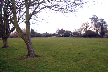
Beeston Green March 2010
Administrative History
Beeston is now part of the ancient parish of Sandy. However, it used to be regarded as part of Northill. This was because the boundary between the Wixamtree Hundred and the Biggleswade Hundred ran along the River Ivel. Thus Sandy was in the Biggleswade Hundred, whereas Beeston and Northill were in the Wixamtree Hundred.
In 1305 there was an agreement between Sandy and Northill that certain houses listed in the parish of Northill owed their tithes to Sandy and the inhabitants ought to go to Sandy church to receive sacraments and be buried.
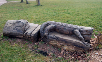
A sculpted seat on Beeston Green March 2010
The Hearth tax return of 1671 divided Beeston between the two parishes with thirty Beeston properties being included in the return for Sandy and twenty seven in Beeston, Thorncote and Hatch included in Northill. This suggests that Beeston Green was, by this time, considered part of Sandy. The part of Beeston in Northill is probably Brook End - in the 20th and 21st centuries this settlement was divided between the civil parish of Northill (the west side of the road) and Sandy (the east side of the road). However, all of Beeston was included in the Inclosure Award for Northill of 1783. Beeston was not included in the Sandy inclosure award of 1804. Beeston was finally recognised as being in Sandy by virtue of the Divided Parishes and Poor Law Amendment Act, 1882 which stated that parts of any parish surrounded by another parish should be absorbed into the surrounding parish. Bedfordshire County Council defined the boundary between Sandy and Northill in an Order of 14th February 1914.
Beeston lies on the A1