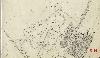
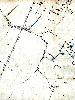
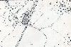
Skip Navigation


Welcome to Bedford Borough Council

Home > Community Histories > Stewartby > Stewartby Maps

Stewartby Maps

To see a larger view of each Ordnance Survey map please click on the relevant thumbnail

Ordnance survery map showing the brickworks at Wootton Pillinge in 1883

The small brickworks at Wootton Pillinge in 1883

 Ordnance survey map showing the brickworks at Wootton Pillinge in 1925

The larger brickworks at Wootton Pillinge in 1925

Ordnance survey map showing Wootton Broadmead in 1883

Wootton Broadmead in 1883

Ordnance survey map showing Wootton Pillinge in 1883

Wootton Pillinge in 1883

Ordnance survey map showing Wootton Pillinge around Green Lane Crossing in 1883

Wootton Pillinge around the Green Lane crossing in 1883

Ordnance survey map showing the beginnings of Stewartby at Green Lane Crossing in 1925

The beginnings of Stewartby around Green Lane crossing at Wootton Pillinge in 1925

Ordnance survey map showing the riginal boundaries of Stewartby in 1937

Stewartby boundaries in 1937