Reach Lane Pits Heath and Reach
Reach Lane Sand Pit June 2008
Heath and Reach has a large number of sand pits dotted around the parish. Those in Reach Lane are the closest to the settlement itself. They were not worked by one of the two local firms for which Bedfordshire & Luton Archives & Records Service has material - J.Arnold & Sons Limited or George Garside (Sand) Limited and so the only records about them are deeds and assessments under the Rating & Valuation Act 1925.
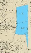
The Rating and Valuation Act 1925 ordered every piece of land and building in the country to be assessed to determine the rates to be paid upon it. The valuer visiting the various Reach Lane quarries noted them as follows. The position of each quarry is shown on the map below, to see a larger version please click on the image. The references such as 233/72 correspond to the references in the text below.
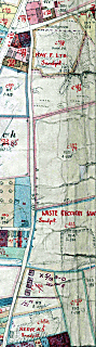
Reach Lane sandpits shown on 1927 valuation map
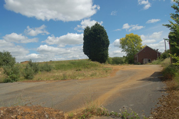
- 254/6: This pit stood where The Dell is now. It was owned and occupied by Mrs.Reeve and comprised 1.188 acres. The untopping (the amount of soil or overburden which had to be removed before the sand layer was exposed) was only 4 feet on average. The valuer noted: "Three men employed sand is dried on site and sold as Bird Sand: address of owner: Hillside, Heath & Reach; weather boarded shed; weather boarded and corrugated iron tool shed; brick, weather boarded and corrugated iron drying shed.
The Dell June 2008
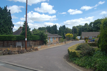
- 233/138: This pit stood at the top of Thomas Street and was owned by Mrs.Claridge of Hollytree Farm and occupied by the Waste Recovery Syndicate Limited on a 99 year lease. They paid no rent but gave the owner a royalty on each ton of sand sold. The pit was quite large at 13.271 acres. Half an acre was used solely for loading the sand lorries. In 1925 half the sand had been used in glass manufacture and half in building - a total of 16,560 tons having been excavated. In 1926 the figure was 14,700 with only a third used for glass manufacture, the rest for building. The quarry employed thirty men and the truck, conveying the sand to the loading area were horse drawn. The untopping here was about 10 feet.
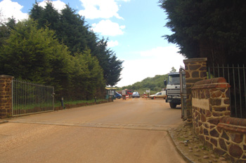 Bryants Lane Quarry June 2008
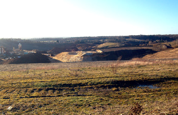
- 233/72: This pit, on the corner of Reach Lane and Bryants Row, the only one still worked was, in 1927, owned and occupied by F.Ray Limited. The valuer noted: "2 men working; average about 15 tons mostly building sand a week. For all information apply to Ray Ltd 25 Cauldwell Street, Bedford". The site comprised 1.918 acres. At the time of writing this large pit is being worked by Leighton Buzzard Silica Sand Limited.
Bryants Lane Pit seen from Overend Green January 2009
Bedfordshire and Luton Archives and Records Service has the lease of land in the angle of Gig Lane and Reach Lane let by Bedford Silica Sand Mines Limited of Salisbury House, City of London to Arthur Rolls of Heath & Reach, farmer at £2 per acre per annum rent in 1930 [BML10/30/59]. In the following schedule the information includes: Ordnance Survey Field Number - description of area occupied by Bedford Silica Sand Mines Limited - area occupied by Bedford Silica Sand Mines Limited - area to be occupied by Arthur Rolls
- 194 - pit, buildings etc. - 10.195 - 0;
- 195 - rail track - 0.332 - 9.141;
- 238 - pit - 0.241 - 7.432;
- 239 - pit - 2.403 - 8.047;
- 273 - pit - 0.728 - 6.854;
- 193 - pit - 3.438 - 2.469;
- 240 - cart way - 0.936 - 6.935;
- 240a - cart way - 0.655 - 0.65;
- 243 - 19.743 - 0;
- 272 - 3.145 - 0
These fields are highlighted on the maps below (naturally the land falls on the join in two maps). Please click on the thumbnails to see larger versions.
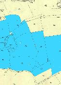
Land rented by Bedford Silica Sand Mines in 1930
In 1931 BSSM Limited took back 4 acres of Field 195, called The Groves, 5 poles of Field 193 called Sand Close and half an acre of Field 239.