Bryants Row Cottages Heath and Reach
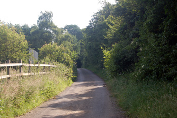
Bryants Lane in June 2008
The houses comprising Bryant's Row no longer exist. They stood on the narrow road running up to Overend Green from Reach Lane, near the junction with Woburn Road and near the Cock Hotel. Today the road runs between two sand quarries, Stone Lane Hill/Chances Pit and a quarry in Reach Lane. They were workers' houses and nothing special, as can be seen on the map above they were a simple terrace. The row is not mentioned on the 1851 census for the village, but is recorded on that for 1861, showing that it must have been built in the ten years between the two.
At that date the row was called Millard's Row and the two names seem to have been used interchangeably through the 19th century, both Millard and Bryant were local farmers and landowners. The eleven houses were occupied by the following heads of household:
- Amos Roberts, 36, a journeyman tailor, born in Heath and Reach;
- Thomas Hines, 44, a Chelsea Pensioner, born in Heath and Reach;
- William Roberts, 31, a railway labourer, born in Heath and Reach;
- Elizabeth Hostler, 50, a washerwoman ("husband left about 6 years"), born in Heath and Reach;
- John Connor, 47, an agricultural labourer, born in Ireland;
- John Weston Connor, 34, an agricultural labourer, born in Heath and Reach;
- Thomas Faunch, 35, a railway labourer, born in Heath and Reach;
- William Davis, 38, an agricultural labourer, born in Heath and Reach;
- William Faunch, 37, a railway labourer, born in Heath and Reach;
- William Hines, 55, an agricultural labourer, born in Heath and Reach;
- Joseph Roberts, 35, an agricultural labourer, born in Heath and Reach.
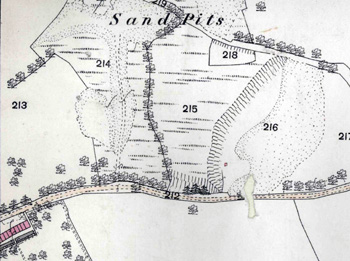
Bryants Row in 1882 (it falls, naturally, on the edge of a map sheet)
The Rating and Valuation Act 1925 ordered that every piece of land and building in the country was to be assessed to determine the rates to be paid on them. Heath and Reach was assessed in 1927 and the valuer visiting the row [DV1/C233/63-71] noted that it was owned by F. Ray and was built of brick and slate. The rent was 3 shillings per week for each house except 2, 3, 10 and 11 which were six shillings per week. The occupiers were:
- 1 - F. Stone;
- 2 and 3 - G. Luff;
- 4 J. Holmes;
- 5 H. Rolls;
- 6 Robinson;
- 7 Mrs. H. Alder;
- 8 William Woolhead;
- 9 A. Turney;
- 10 and 11 J. Capp.
Numbers 1 and 4 comprised a living room, kitchen and scullery downstairs with three bedrooms above. Numbers 2 and 3, evidently combined into one residence, had two living rooms, two kitchens, two sculleries and six bedrooms. The valuer considered this combined residence "poor". The similarly combined numbers 10 and 11 had two parlours, two living rooms and two sculleries downstairs with four bedrooms above. The rest, Numbers 5, 6, 7, 8 and 9 simply contained a living room, kitchen and scullery downstairs, with two bedrooms above.
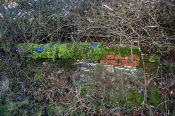
The remains of a wall in Bryants Lane January 2009
The valuer considered the whole row to be poor and commented: "One earth closet for two houses" and "barn each". The row was evidently demolished before 1968 as it does not appear on the Ordnance Survey 25 inches to the mile map for that year held by Bedfordshire & Luton Archives & Records Service. Traces of the old front walls (semingly those demarking the properties rather than the walls of the houses) can still be seen on the right hand side as one climbs Bryants Lane from the junction with Woburn Road.