The Community of Biggleswade in General
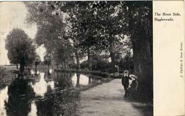
River Ivel at Biggleswade 1907 [ref: Z1306/16/27/6]
Landscape
Volume 2 of The Victoria County History for Bedfordshire was published in 1908. At that date the parish of Biggleswade contained 4,647½ acres, of which 2,932 acres were arable and 1,148½ used for grazing animals; there were 6½ acres of woods and plantations. The ground slopes from south to west. The west of the parish, which is bounded by the River Ivel is especially low-lying and liable to flooding. The highest point is Toplers Hill in the south, which is 249 feet above sea level.
The parish of Biggleswade has two hamlets, Stratton to the south-east of the town and Holme to the south.
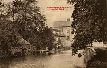
Holme Mill c.1910 [ref: Z1306/16/26/4]
Name
According to Bedfordshire Place Names by A. Mawer and F. M. Stenton the name Biggleswade means ‘Biccel’s ford’, waed being an Anglo-Saxon word meaning ‘ford’ and Biccel being the diminutive form of the Old English name Bicca.
Various forms of Biggleswade which have been recorded include: Pichelesuuade (1086); Bicheleswade (1132); Bic(h)leswade (1175, 1227-1229); Bikeleswade (1183-1220); Bickeleswade (1240-1255); Becleswade (1438); Beklyswade (1480); Bygelswade (1486); Bygleswade (1535)
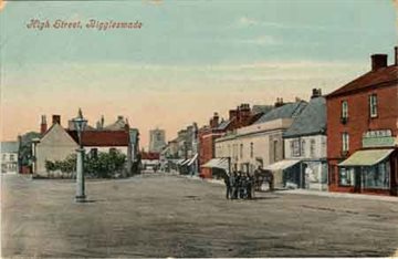
High Street, Biggleswade 1905 [Z1306/16/12/2]
Administrative History
Biggleswade is an ancient parish in the east of Bedfordshire and is part of Biggleswade Hundred. It is bordered by Northill, Old Warden and Southill to the west, Sandy and Sutton to the north, Dunton and Edworth to the east, and Langford and Astwick to the south.
From 1891 to 1974 Biggleswade was an Urban District. As part of local government reorganisation in 1874 the Urban District was abolished and Biggleswade was incorporated into the new Mid Bedfordshire District Council, with a new Biggleswade Town Council responsible for local affairs and community facilities. The Town Council is now based in the former Magistrates’ Court in Saffron Road. In 2009 Mid Bedfordshire District Council amalgamated with South Bedfordshire District Council and elements of the abolished Bedfordshire County Council to form Central Bedfordshire unitary authority.
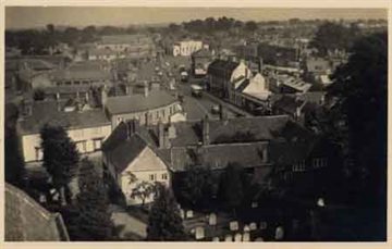
View from Biggleswade Church, c.1926 [ref: Z1306/16/3/1]
Population
The Hearth Tax of 1671 (transcribed in Bedfordshire Historical Records Society Volume 16 in 1934) records 140 dwellings in Biggleswade for a total of 311 hearths. It has been estimated that this represented a population of about 642. The largest number – fifteen - was in the house of henry Drewry.
The occasional visitation by the Bishop of Lincoln to Bedfordshire in the early 18th century gives important social information. Each vicar or rector had to complete a return about his parish. These are particularly useful for the state of education but give other insights. Former County Archivist Patricia Bell has compiled returns from 1706 to 1720 for the Bedfordshire Historical Records Society (Volume 81, published 2002); information for Biggleswade includes the following:
- 1706: Biggleswade was “of a large extent, and contains about 200 families”;
- 1709: 180 families and 900 “souls”;
- 1717: “We have in our Whole Parish 246 families”;
- 1720: "We have near 250 families"
From the 19th century the population of the town of Biggleswade can be traced from census returns: 1801: 1,794
- 1811: 1,895
- 1821: 2,778
- 1831: 3,226
- 1841: 3,807
- 1851: 4,460
- 1861: 4,631
- 1871: 5,183
- 1881: 4,947
- 1891: 4,943
- 1901: 5,120
- 1911: 5,375
- 1921: 5,395
- 1931: 5,844
- 1951: 7,431
- 1961: 8,050
- 1971: 9,605
- 1981: 10,928
- 1991: 12,734
- 2001: 15,383
- 2011: 16,551
- 2021: 22,541