The Parish of Heath And Reach in General
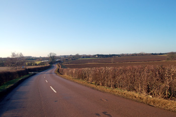
View to Overend Green from Fourne Hill December 2008
Landscape
The modern civil parish of Heath & Reach contains 2,330 acres [943 hectares]. The parish stands quite high - the church stands about 385 feet above sea-level but the highest part of the parish is at 480 feet close to the junction of Overend Green Road and Stone Lane Hill. Stockgrove Park reaches up to about 420 feet but the River Ousel along Old Linslade Road is just 265 feet or so above sea-level.
The solid, or underlying, geology varies. Most of the parish lays on top of a form of sandstone called Woburn Sands Formation, laid down between 154 and 164 million years ago in warm, shallow Jurassic seas. However, the high ground at Overend Green and along Eastern Way has a solid geology of mudstone known as Gault Formation, laid down between 99 and 112 million years ago in the seas of the Cretaceous Period. Along Old Linslade Road lies a thin band of mudstone known as West Walton Formation mixed with another type of mudstone called Ampthill Clay Formation, both laid down between 154 and 159 million years ago. To complete the complex solid geology, along the Ousel and the mill stream is a band of mudstone called Oxford Clay Formation laid down between 154and 164 million years ago.
Most of the soil in the village is sandy, often very sandy, which comes as no surprise given the number of sand quarries there are, and have been, in the area. Above the Gault Formation, however, is a top soil of glacially deposited till and along the Ousel an alluvium of mixed sand, gravel, clay and silt.
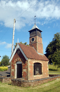
Heath Green clocktower and pumphouse June 2008
Administrative History
Heath & Reach was a hamlet (or a number of hamlets - Heath, Reach and Nares Gladley) in the ancient parish of Leighton Buzzard. Nares Gladley, then just Gladley is mentioned as being a separate manor in the Domesday Book of 1086 and continued a separate identity from the Royal Manor of Leighton Buzzard, later the Manor of Leighton Buzzard alias Grovebury.
Heath and Reach are first seen as hamlets in the late 13th century and are not mentioned as being a combined hamlet until the mid 18th century. Heath & Reach became a separate ecclesiastical parish in 1826 and a separate civil parish in 1866.
Heath & Reach is bordered by Soulbury [Buckinghamshire] to the west, Little Brickhill [Buckinghamshire] to the north-east, Potsgrove to the east and north-east, Hockliffe to the south-east, Eggington to the south, Leighton Buzzard to the south and Linslade to the south-west. The boundary between Heath & Reach and Potsgrove is formed by the Roman Road later called Watling Street, now the A5.
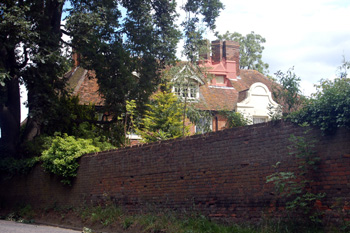
Heath Manor from the south June 2008
Name
The name Heath is first found in the Assize Rolls for Bedfordshire in 1276 as le Hethe. The name, of course, is self-explanatory - much of the parish's landscape is of the sandy heathland variety.
Reach is first recorded in the Ramsey Abbey cartulary between 1216 and 1231 as Reche. The word reach refers to a portion of river. If so this refers to that part of the parish around Nares Gladley, the boundary of which is the River Ouzel. However, as Nares Gladley was a separate settlement and not particularly close to the modern Reach Green this seems puzzling.
Suggestions made in Bedfordshire Place Names by A.Mawer and F.M.Stenton in 1926 include "way, path, narrow path up a cleft or ravine" from the Old Norse word rák. Again, this does not particularly suit the situation of Reach, unless it refers to the narrow path from Reach to Leighton Buzzard which ran past Craddock's Camp. Another possible derivation is from a Wiltshire dialect word "rake" meaning a row of houses, though Heath & Reach is some way from Wiltshire!
Nares Gladley is also a bit of a mystery as the Nares element is comparatively modern, not found until after the Middle Ages. Gladley may derive from an Anglo-Saxon personal name Glaeda. The name is first recorded in the Domesday Book of 1086 as Gledelai and has gone through a number of variations: Gledele or Gledeleg (1131-1379); Gledeleia (1176); Gladelaia (1176); Gladelea (1177) and Gledley or Gledeley (1499).
Heath and Reach are first seen together as late as 1750 as Hetheredge, or Heathanreach in 1785.
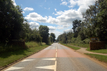
Woburn Road looking south June 2008
Population
The Hearth Tax of 1671 (transcribed in Bedfordshire Historical Records Society Volume 16 in 1934) records 76 dwellings in Heath & Reach for a total of 151 hearths. It has been estimated that this represented a population of about 323. The largest number - eleven - were in the house of "Mr.Vaux". The house of Robert Marke contained a forge, clearly suggesting he was the smith.
The occasional visitation by the Bishop of Lincoln to Bedfordshire in the early 18th century gives important social information. Each vicar or rector had to complete a return about his parish. These are particularly useful for the state of education but give other insights. Former County Archivist Patricia Bell has compiled returns from 1706 to 1720 for the Bedfordshire Historical Records Society (Volume 81, published 2002); information for Heath & Reach is included in the return for Leighton Buzzard for 1706 only and is as follows: "In the Hamlet of Heath & Reach 83 families"; a population of perhaps between 300 and 350.
Census returns enable us to chart the changes in populations in Heath & Reach from 1801, even though it did not become a separate civil parish until 1866. The loss of population between 1931 and 1951 was occasioned by part of the parish, the northern end of Heath Road, being transferred from Heath and Reach to Leighton Buzzard in 1933.
- 1801: 541;
- 1811: 586;
- 1821: 726;
- 1831: 784;
- 1841: 856;
- 1851: 925;
- 1861: 953;
- 1871: 1,120;
- 1881: 1,075;
- 1891: 1,090;
- 1901: 1,062;
- 1911: 1,028;
- 1921: 923;
- 1931: 1,022;
- 1951: 816;
- 1961: 922;
- 1971: 1,103;
- 1981: 1,247;
- 1991: 1,316;
- 2001: 1,285;
- 2011: 1,346.