The Parish of Northill in General
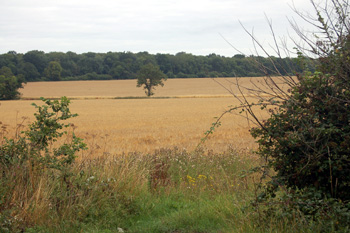
Countryside near Highlands Farm August 2010
Landscape
Northill is a large parish of some 4,140 acres and includes the settlements of Brook End, Budna, Hatch, Ickwell, Lower Caldecote, Thorncote and Upper Caldecote as well as the village of Northill itself. Volume III of The Victoria County History for Bedfordshire was published in 1912. At that date Northill had 2,142 acres under arable cultivation, mostly wheat, oats, barley, beans, peas and market gardening produce, with 753 acres of permanent grass and 271.5 acres of woodland.
The parish contains a feeder stream to the River Ivel, which forms the eastern boundary of the parish. The land is low lying, only 205 feet above sea level at its highest point (in the west) dropping to a low point of 74 feet in the north. The church stands at about 115 feet above sea-level, Highlands Farm at about 160 feet and the eastern end of Sand Lane about 100 feet. The site of the former Lion Beerhouse at the boundary with Biggleswade stands at 90 feet above sea-level.
The solid, or underlying, geology is a mudstone and associated clay above it called Oxford Clay Formation, laid down between 154 and 164 million years ago in the warm, shallow seas of the Jurassic Period. A north-south band of till forms a superficial deposit across Bedford Road just west of the church to just north of The Barracks and there is a area of glacially deposited sand and gravel west of this.
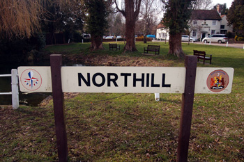
Northill sign March 2010
Name
Northill is first recorded, as Nortgiuele and Nortgible, in the Domesday Book of 1086. Early forms of the name make in clear that the meaning is not "north hill" but "north Ivel". Other forms of the name recorded are:
- Northgille (1185);
- Norttgifelle (C13th);
- Northgiuele (1219-1294);
- Nortgylle (1242);
- Nortgiuel (1247);
- Northgevle (1271);
- Northyeuil (1287);
- Northyevele (1290-1387);
- Nortgewele (C13th);
- Nortgivill (C13th);
- Northyvele (1303-1364);
- Northevele (1346);
- Norrell (1443):
- Northyevyll (1470:
- Northyell (1494);
- Northewell (1526);
- Norryel (1535):
- Northyell (1535);
- Northiell (1536);
- Norrihill (1537);
- Norhill (1675).
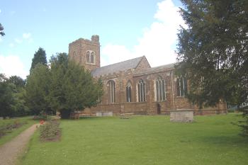
The church from the south-east July 2007
Administrative History
Northill is an ancient parish in the Wixamtree Hundred. It was the site of a collegiate church from 1404 to 1547. The village lies in the middle of the parish with Budna to the north-west, Thorncote Green to the north, Hatch and Brook End to the north-east, Lower Caldecote to the east, Upper Caldecote to the south-east and Ickwell to the south.
Northill is bordered by Mogerhanger to the north and north-west, Sandy to the north-east, Biggleswade to the east, Old Warden to the south and Willington to the west. Beeston, now in the civil parish of Sandy was, at least partly, in Northill until the end of the 19th century.
![The threshing process in 1939 [Z50/84/77]](/CommunityHistories/Ickwell/IckwellImages/The threshing process in 1939 [Z50-84-77]_350x199.JPG)
The threshing process in 1939 [Z50/84/77]
Population
Northill has always been a reasonably populated parish, mainly because of the presence of so many hamlets. At the time of the Domesday Book 26 villagers, smallholders and slaves are noted; this figure should be multiplied by at least four to allow for these men's dependents - giving a total population of something over a hundred - a decent sized parish for the date. The population figures for the parish were reasonably static for over a century, the total in 1841 being 1,280 and in 1951 1,298. In the next half century the population grew to nearly double. The figures do not give a breakdown between the various settlements.
- 1801: 715;
- 1811: 870;
- 1821: 1,001;
- 1831: 1,106;
- 1841: 1,280;
- 1851: 1,364;
- 1861: 1,366;
- 1871: 1,428;
- 1881: 1,412;
- 1891: 1,408;
- 1901: 1,348;
- 1911: 1,292;
- 1921: 1,332;
- 1931: 1,228;
- 1951: 1,298;
- 1961: 1,446;
- 1971: 1,721;
- 1981: 2,164;
- 1991: 2,127;
- 2001: 2,284;
- 2011: 2,270.