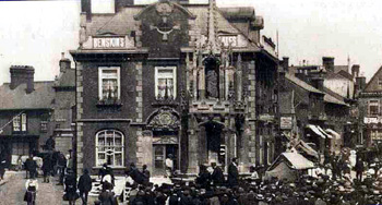
The newly built Cross Keys about 1900 [Z1306/72]
In 1473 the Fraternity or Guild of Corpus Christi was founded in Leighton Buzzard by the Lady of the Manor, the Duchess of Suffolk. The guild had two guardians and brothers and sisters from the parish and was intended to support a chaplain celebrating mass daily in All Saints' church. The Fraternity had a house which was probably in the "island site" in the middle of the Market Square called Middle Row, perhaps the building which became the Cross Keys public house, burned down and was rebuilt in 1899 and is now [2008] a branch of Lloyds TSB Bank. The Brotherhood was dissolved at the Reformation, in 1547 and their property sold or granted to others.
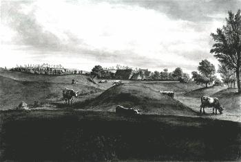
Site of Grove Priory about 1812 [Z315/3]
The old manor site at Grovebury, established since the days of the Priory, seems to have gone into decline after the 15th century. The last mention of a functioning chapel on the site may be in a will of 1576 in Buckinghamshire Museum: "Chappell Cloase wherein the Chappell standethe". New buildings were added during the 16th and 17th centuries and the old graveyard became a rubbish heap. Then slowly the farm dwindled until only the chapel remained but it was certainly no longer used for any religious purpose, being partitioned and one end used for storage whilst the other became living accommodation. Much of the stone from the old manorial complex was used to build Grovebury Farm. The buildings were demolished in the 20th century but in 1919 antiquarian F.G.Gurney visited them and recorded features consistent with a 16th or 17th century date. In 1581 the Lords of the Manor, the Dean and Chapter of Saint George's Chapel, Windsor issued a licence to Clement Duncombe to build a dwelling at Grovebury suggesting that this was the genesis of Grovebury Farm.
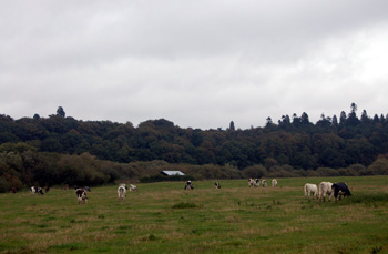
The Heath seen from Old Linslade Road October 2008
Sir Christopher Hoddesdon, chief tenant of the Manor under the Dean and Chapter from the 1580s, seems to have let the manor properties fall into neglect, from which they had to be rescued by the Leigh family of Stoneleigh, tenants from 1610 onwards. Hoddesdon began to use The Heath, the area effectively between today's Heath Road and Plantation Road, as a rabbit warren [BO1335]. He then enclosed part of The Heath in an attempt to cater for more rabbits, thus infringing the common rights of tenants of the manor and giving rise to a number of law suits. About 1595 Hoddesdon gave up the right of warren on the Heath in return for the right to inclose part of The Heath as far as King's Wood in Heath & Reach. The tenants, however, destroyed his inclosing fences. One of the first documents of the Leigh tenure as chief tenant is a lease of the warren which is described as: "Lodge Warren of conies in Leighton Buzzard heath. Thomas Taylor to preserve at least four hundred conies and to give Sir Thomas Leigh six couple of the best he can catch between 1st November and 2nd February each week, to be allowed twelve pence per couple off the rent" [KK608].
The Leighs also maintained the hundred acre park inclosed by Hoddesdon from part of The Heath, it is not clear where this was but may have been in Heath & Reach in the area of Nares Gladley. The warren was eventually destroyed in 1631 when Leigh agreed that on payment of £50 the tenants could catch and kill the rabbits and no further warren would be established; rabbits were in future only to be kept in the park.
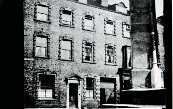
1-5 Market Square in the late 19th century [Z50/72/130]
In 1645 a fire occurred in the High Street which meant rebuilding was necessary. Around 10,000 Parliamentary troops were billeted in Leighton Buzzard and Dunstable and the surrounding area at the time and the matter was taken to the House of Lords on 23rd July 1645: "Petition of the distressed inhabitants of Leighton Buzzard, Beds. By a fire which happened on the 7th of March last, great damage was done to buildings and property in the town, amounting to £14,368/17/-. Petitioners, who have been forward in all payments for Parliament, and have in consequence been mercilessly plundered by the enemy, pray that the House will grant them a collection in London and elsewhere for their relief". Nearby Woburn was burned by Royalist troops in November of that year.
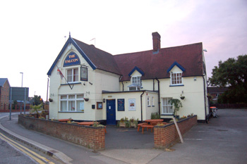
The Falcon public house, close to Chain Bridge in June 2008
The bridge over Clipstone Brook at the convergence of Stanbridge Road, Billington Road and Lake Street (which led, confusingly, to the lower reaches of the latter street being called Bridge Street) was only a foot bridge even at the beginning of the 19th century, wheeled traffic having to use an adjacent ford. A new bridge, for all traffic, was built in 1817 [CRT130LEI5b] and became known as Chain Bridge. The bridge had to be rebuilt in 1879 after flooding destroyed its walls. East of Chain Bridge lay an area of common land called Goose Green which flanked the east side of Lake Street.
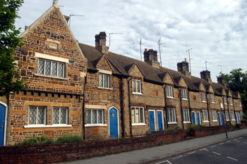
Wilkes Almshouses June 2008
Woburn Street and North End (today's North Street), as can be seen from Benjamin Bevan's map of 1819 was an area occupied by smaller properties than those in the High Street or Lake Street. They were clearly, for the most part, tenements for poorer workers. Significantly the town's first workhouse and almshouses for the poor lay respectively just off and on North Street.
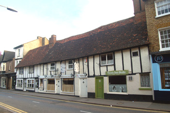
19-21a Hockliffe Street June 2008
Hockliffe Street, formerly called Jeffs Lane and Gig Lane may have been part of medieval Leighton Buzzard or a later development but certainly seems to have been in place by the 15th century as noted in manorial court rolls [KK944/2]. Its narrow width suggests it was a later development than the broad High Street and Lake Street. The only development along the street seems to have been at its west end where it ran into the Market Square up to the modern 21a Hockliffe Street before the middle of the 19th century.
Bossard Hall June 2008
The modern West Street was originally called Friday Street (the modern Friday Street being called Stairs Lane) and this seems to have begun to be developed in the last half of the 18th century and first half of the 19th century, as Bevan's map shows. The street seems to have been originally just a back lane for properties on the north side of the High Street and was called Back Lane into the 19th century and even on the 1901 Ordnance Survey map. The modern Bassett Road, running up towards Leighton Mill also had some minor development before the middle of the 19th century. Other areas seeing some minor settlement were all off North End - Birds Eye Lane (Bedford Street), Saint Andrew's Street, Lammas Walk and Windmill Road (Beaudesert).
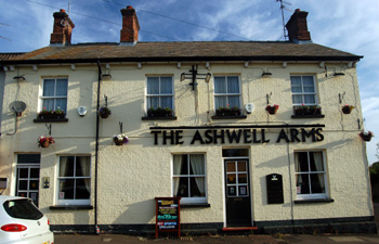
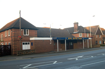
The Ashwell Arms June 2008
The first great surge in the development of Leighton Buzzard from a medieval market town came after the inclosure of the town in 1848. Inclosure meant the break up of the old medieval system of large, open fields in which individuals had strips to farm into the modern pattern of smaller inclosed fields; each individual receiving land proportionate in size and quality to their strips in the old common fields. Newly inclosed fields were quickly sold off as building plots as the town began to grow following the arrival of the London and North Western Railway at Linslade in 1838. A large part of this development took part in the existing roads either side of North Street such as Bedford Street as well as a whole network of newer roads such as Ashwell Street. The town also began to expand northwards along modern Church Street, Heath Road and Plantation Road. This phase of building was comparable to that on the eastern outskirts of the town between Billington Road and Vandyke Road since the Second World War.