The Community of Knotting in General
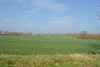
Looking north April 2015
Landscape
Knotting lies on a solid geology of Oxford Clay, a mudstone laid down between 154 and 164 million years ago in the shallow seas of the Jurassic Period. The soil here is a type of diamicton known as Oadby Member, laid down in the ice ages of the last two million years. This gives a black, loamy soil. The church stands at 310 feet above sea-level. Knotting Green is considerably lower lying between 255 and 261 feet above sea-level.
When Volume III of The Victoria County History for Bedfordshire was published in 1912 the parish of Knotting comprised 1,739 acres, of which 864 were arable and 603 permanent grass. The chief crops were then wheat, barley, beans and peas.
Name
Knotting means “Cnotta’s people”, the first element being a personal name. It is first recorded in the Domesday Book of 1086 and has undergone a number of variations over time:
- 1086: Chenotinga;
- 1163-1428: Cnottinge;
- 1163-1428: Knottinge;
- 1163-1428: Knottynge;
- 1224: Cnottinges;
- 1276: Gnottinge;
- 1287: Knotynge;
- 1287: Knotyngge;
- 1287: Knotyigge;
- 1325-1492: Knottingg;
- 1325-1492: Knottyngg;
- 1337: Knotymg
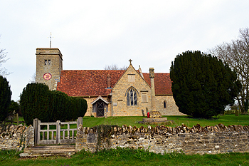
The church from the south March 2014
Parish Administration
Knotting was a chapelry in the ancient parish of Melchbourne in the Stodden Hundred. It became a separate parish in 1176. It was surrounded by Higham Park [Northamptonshire] to the north-west, Newton Bromswold [Northamptonshire] to the north, Yelden to the north, Melchbourne to the north-east, Riseley to the east, Bletsoe to the south-east, Sharnbrook to the south and Souldrop to the west. The parish has two main settlements, that around the church and Knotting Green on the lower ground to the west.
Being a sparsely populated place, in 1735 the ecclesiastical parish of Knotting was combined with the living of Souldrop. The civil parish followed suit just under two centuries later: in 1934 the civil parish was also merged with Souldrop to form one civil parish of Knotting and Souldrop. It lies in the unitary council area of Bedford Borough.

1-2 Strawberry Hill Cottages April 2015
Population
Knotting has never been a well-populated parish in modern times. The Domesday Book of 1086 records 8 villagers, 5 smallholders and 4 slaves for a total of 17. These would have been the heads of household, so to arrive at an approximate number of inhabitants it is necessary to multiply this figure by a factor of at least four – suggesting a population in excess of fifty, making it more significant at that time, statistically, than today.
The census figures for Knotting up to 1931 are given below. It is interesting to observe that it is only in the early years of 20th century that Knotting’s population fell away significantly from 187 in 1851 to 107 fifty years later.
1801: 105
1811: 117
1821: 135
1831: 165
1841: 175
1851: 187
1861: 185
1871: 183
1881: 186
1891: 161
1901: 107
1911: 120
1921: 118
1931: 114
Knotting and Souldrop
1951: 281
1961: 258
1971: 261
1981: 261
1991: 246
2001: 269
2011: 238