The Parish of Kensworth in General
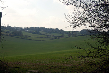
View south-west from Hollicks Lane March 2012
Landscape
Extending over Dunstable Downs as it does it comes as no surprise that the solid, or underlying, geology of Kensworth is all chalk, however it is chalk of two different types. All the buildings along Common Road and a C-shape around the buildings in Church End are all on a type of chalk known as Lewes Nodular Chalk Formation and Seaford Chalk Formation (Undifferentiated). This was laid down between 84 and 94 million years ago in the warm, shallow seas of the Cretaceous Period.
The buildings at Church End, together with land around Isle of Wight Lane and then the road into Dunstable are on chalk called Holywell Nodular Chalk Formation and New Pit Chalk Formation (Undifferentiated). This was also laid down in the Cretaceous Period between 89 and 99 million years ago. This subsoil also extends along the A5, the eastern part of Lynch Hill and under all the buildings at The Lynch but here it has a subsoil overlying it composed of a material called Head, a mixture of gravel, sand, silt and clay deposited up to 2 million years ago.
The parish of Kensworth varies dramatically in height, covering a range of over 300 feet, rising roughly east to west. At the Pack Horse Public House on the A5 the land is 454 feet above sea-level. It rises to 489 feet at Corner Farm and 560 feet at Kensworth House. Kensworth church stands at 620 feet above sea-level whereas the bottom of Hollicks Lane, where a deep dry valley cuts across the landscape, the height is 546 feet. On the opposite side of the valley the Farmer’s Boy stands at 635 feet, falling away to the east with the school standing at 590 feet above sea-level. The highest points in the parish are, of course, on the downs. The site of the former California Beerhouse, on the downward slope into Dunstable, stands at 678 feet whereas the junction of Isle of Wight Lane and Whipsnade Road is as high as 770 feet above sea-level.
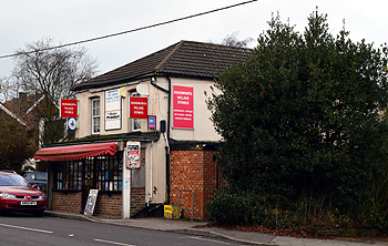
Kensworth Village Stores - 36 Common Road January 2013
Name
The name means Cen’s enclosure and dates from the Anglo-Saxon period. The name has undergone a number of changes over the years as the following list shows.
- Canesworde: 1086;
- Kenesword: 1131-1286;
- Keneswurda: 1168;
- Keneswurth: 1227-1286;
- Keneswrthe: 1227;
- Kemeswurth: 1247;
- Kenesworth: 1286-1402;
- Kennesworth: 1431-1435
The first recording of the modern spelling was as early as 1375.
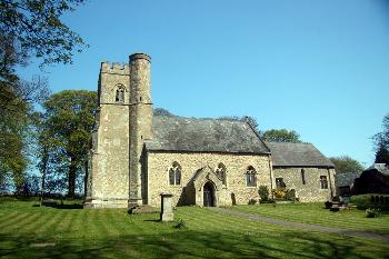
The church from the south August 2007
Administrative History
Kensworth is an ancient parish and for most of its history lay in the Dacorum Hundred of Hertfordshire. However, it has a complicated history in the 19th century. In 1834 poor law unions were established, with large central workhouses, to administer relief to the poor of an area. Kensworth, though still in Hertfordshire, was included in the Luton Poor Law Union. From 1863 it was also included in the Luton Highway District. In 1894 Kensworth was included in the new Markyate Rural District.
Then, in 1897 the civil parish was transferred to Bedfordshire, under the Local Government Act 1888, as it was now wholly encircled by the county with the transfer of large parts of the Hertfordshire sections of Studham and Caddington, previously both parishes divided into two by the county boundary, to Bedfordshire. It now formed part of Luton Rural District.
The ecclesiastical parish lay in the Diocese of Lincoln, being part of Berkhamstead Rural Deanery and Huntingdon Archdeaconry, until 1845 when the whole deanery was transferred to Saint Albans Archdeaconry in the Diocese of Rochester. In 1863 it became part of the Archdeaconry of Rochester and Saint Albans. The new Diocese of Saint Albans was created in 1877 and Kensworth formed part of Berkhamstead Deanery. In 1907 it was transferred to the Saint Albans Deanery and finally, in 1930, it was moved into Dunstable Deanery and the Archdeaconry of Bedford.
The South Bedfordshire (Parishes) Order 1985 transferred land from Totternhoe to Kensworth, including Landpark Wood and Allcroft Wood with their attendant buildings. Shortgrove Manor Farmhouse was transferred from Whipsnade to Kensworth and some uninhabited areas of land transferred from Kensworth to Whipsnade [MCDP87/5]
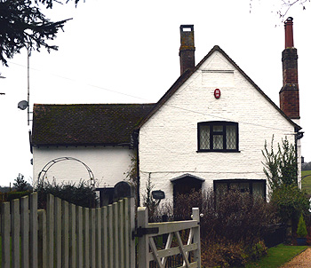
Chequers Cottage January 2013
Population
The Domesday Book of 1086 recorded that Kensworth had eight villagers, three smallholders and three slaves. These people were the heads of household and need to be multiplied by a factor of at least four to give some idea of the population – perhaps around sixty.
The following figures are taken from censuses. They show a dramatic rise and fall – the number of people in 1801 more or less doubling by 1851 then falling back to the level of a century before by 1901. This is largely accounted for by agricultural depressions and the advent of increasing mechanisation coupled with the growth of nearby towns, especially Luton, with the advent of the railways and trade and industry they brought.
The population doubled overnight between 1961 and 1971 with the building of large numbers of modern houses. It nearly doubled again by 1981 and then was more than halved by 1991. This was because the South Bedfordshire (Parishes) Order 1985 altered the parish boundaries. A small area of land at the west end of the village was transferred to Kensworth from Studham but two estates of modern housing in the north of the parish were transferred to Dunstable.
- 1801: 510;
- 1811: 522;
- 1821: 615;
- 1831: 732;
- 1841: 842;
- 1851: 1,033;
- 1861: 925;
- 1871: 891;
- 1881: 655;
- 1891: 605;
- 1901: 516;
- 1911: 528;
- 1921: 545;
- 1931: 583;
- 1951: 817;
- 1961: 930;
- 1971: 1,822;
- 1981: 3,238;
- 1991: 1,516;
- 2001: 1,503;
- 2011: 1,455.