Higham Gobion Maps
The map below is from the Lucas archive and relates to the Manor of Higham Gobion, held by the Grey family, predecessors to the Lucas family. It dates from 1700. To see a larger version please click on the image
![Higham Gobion in 1700 [X1-97-40]](/CommunityHistories/HighamGobion/HighamGobionImages/Higham Gobion in 1700 [X1-97-40]_350x312.jpg)
Higham Gobion in 1700 [X1/97/40]
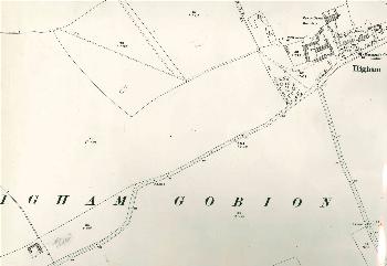
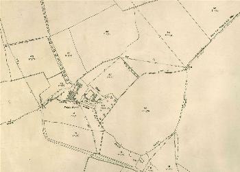
The images below are from the Tithe Apportionment map of 1838 and include both Higham Gobion and Faldo. To see a largerversion please click on the appropriate image.
![Higham Gobion in 1838 [MAT21]](/CommunityHistories/HighamGobion/HighamGobionImages/Higham Gobion in 1838 [MAT21]_349x247.jpg)
Higham Gobion in 1838 [MAT21]
![Faldo in 1838 [MAT21]](/CommunityHistories/HighamGobion/HighamGobionImages/Faldo in 1838 [MAT21]_304x300.jpg)
Faldo in 1838 [MAT21]
The images below are from the 3rd edition 25 inches to the mile Ordnance Survey maps of 1924. To see a larger version please click on the appropriate image.
Higham Gobion in 1924
Faldo Farm in 1924